Angkor’s Water System and the Khmer Empire
Students examine maps, environmental evidence, and historical sources to explain how Angkor’s water-management system supported the Khmer Empire and later became vulnerable to environmental change.

Illustrations are auto-generated and may be placeholders. They can be refreshed to match the narration.
Mapping the Khmer Empire
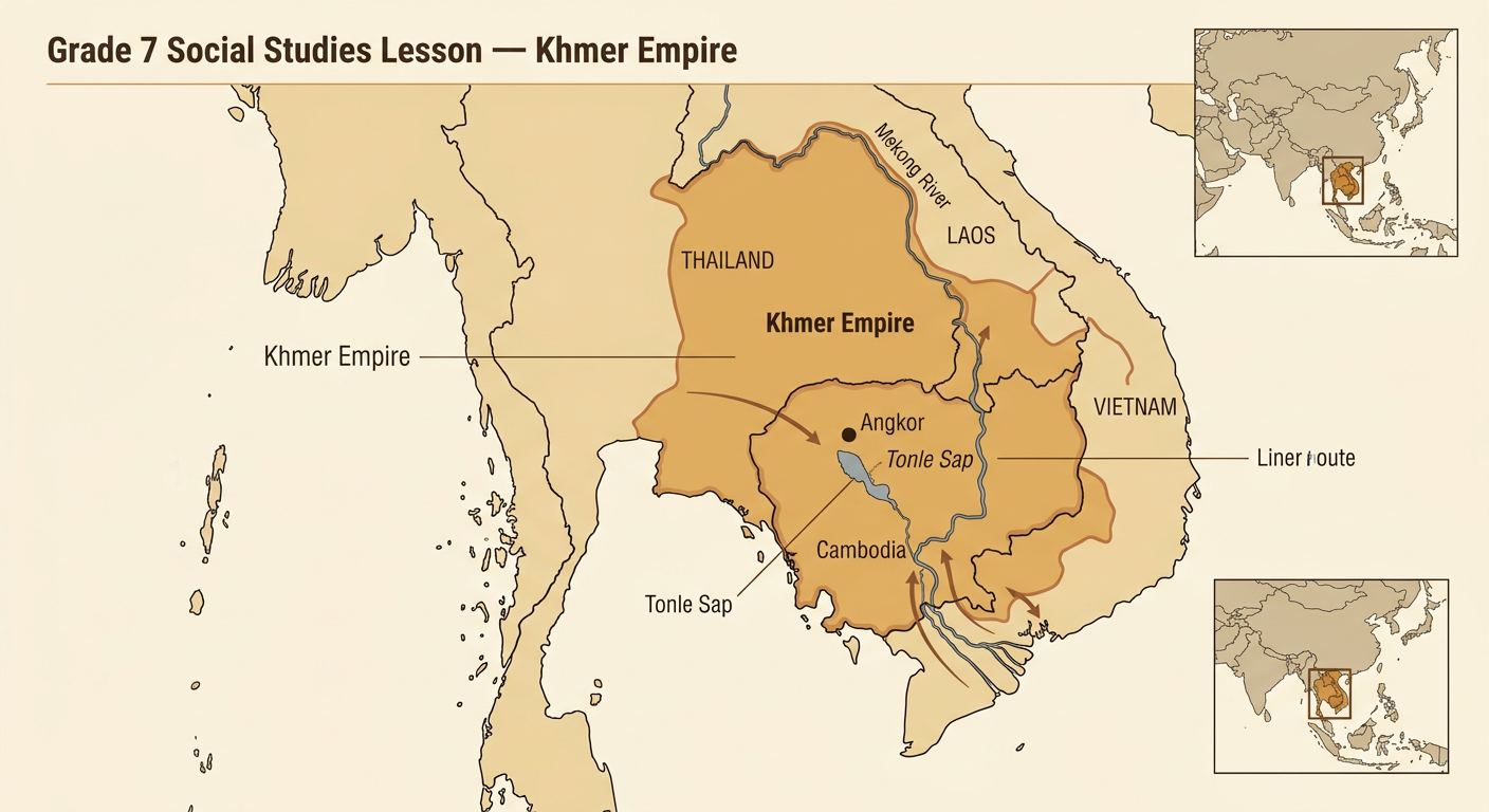
The Khmer Empire flourished in mainland Southeast Asia from the 800s to the 1400s. Its capital region, Angkor, was located in present-day Cambodia, north of Tonle Sap, Southeast Asia’s largest freshwater lake. At different times, Khmer rulers controlled or influenced territory that is now part of Cambodia, Thailand, Laos, and Vietnam. Angkor’s location offered access to fertile plains, seasonal rainfall, rivers, forests, and trade routes. Maps help historians connect these geographic features with the empire’s growth. For example, a map showing Angkor near Tonle Sap suggests how people could obtain fish, move goods, and use seasonal floodwaters. However, the empire’s boundaries changed as rulers gained or lost influence, so a historical map represents one period rather than a permanent border.
Monsoons and the Water Cycle
Angkor’s climate is shaped by monsoons, seasonal wind patterns that bring wet and dry periods. During the wet monsoon, moist air produces heavy rain. Solar energy drives evaporation from oceans, lakes, soil, and plants. Water vapor cools and condenses into clouds, then falls as precipitation. Gravity pulls rainwater downhill as runoff into streams, canals, ponds, reservoirs, and Tonle Sap. Some water also soaks into the ground. During the dry season, rainfall decreases, but stored water can remain available. For example, rain falling on higher ground near Angkor could flow by gravity through channels toward lower fields. Khmer builders had to work with this changing cycle by moving, storing, and draining water rather than relying on steady rainfall throughout the year.

Reservoirs, Canals, and Rice Farming
Angkor contained a large network of canals, embankments, ponds, moats, and rectangular reservoirs called barays. These structures collected, redirected, stored, and drained monsoon water across a mostly low, gently sloping landscape. Water management helped communities reduce flooding in some places and keep water available during dry periods. It also supported households, religious sites, transportation, and agriculture. Rice farming depended on suitable timing and depth of water, so farmers could use local channels and field embankments to guide water. For example, an embankment could hold shallow water in a rice field after rain, while an outlet released excess water. Scholars continue to study exactly how each large baray was used; some likely had religious and political purposes as well as practical roles within the wider water network.

Reading Angkor’s Scale Map
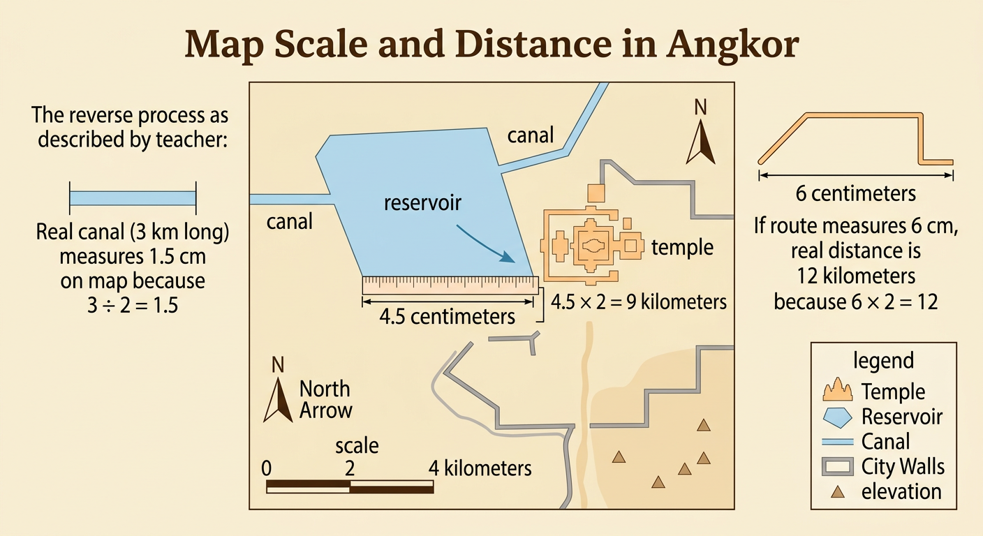
A scale map shows large real-world distances in a smaller, proportional form. Suppose an Angkor map uses a scale of 1 centimeter to 2 kilometers. If the distance between a reservoir and a temple measures 4.5 centimeters on the map, the actual distance is 9 kilometers because 4.5 multiplied by 2 equals 9. A canal measuring 3 kilometers in the real landscape would appear 1.5 centimeters long on that map. Students should first check the scale, measure carefully, and keep units consistent. Scale calculations can reveal how much labor and planning a water network required. A canal that looks short on a page might extend for many kilometers across the landscape. Direction symbols, elevation marks, and legends also help readers determine where water could move under the force of gravity.
Water Management and Imperial Power
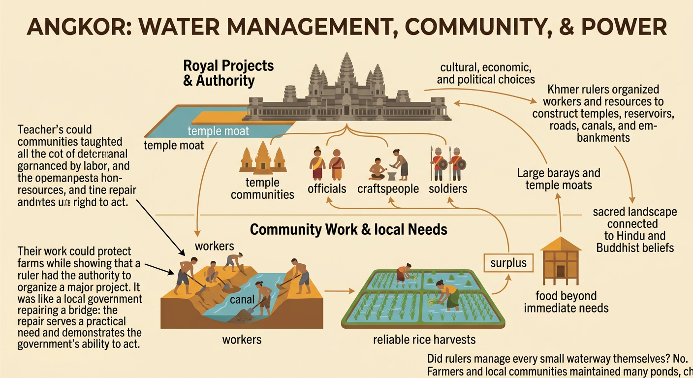
Angkor’s water system reflected cultural, economic, and political decisions. Khmer rulers organized workers and resources to build temples, reservoirs, canals, roads, and embankments. These projects could support farming and settlement while also displaying the ruler’s power and religious authority. Temple moats and large barays shaped a sacred landscape connected to Hindu and Buddhist beliefs. Economically, dependable rice harvests helped feed residents and may have produced surpluses that supported officials, craftspeople, soldiers, and temple communities. For example, leaders who coordinated the repair of a damaged canal could protect fields and demonstrate their ability to maintain order. Yet decisions were not made by rulers alone. Farmers and local communities also maintained smaller ponds, channels, and field boundaries. The system therefore linked government authority with the daily labor and water needs of many people.
Environmental Strain and Angkor’s Decline
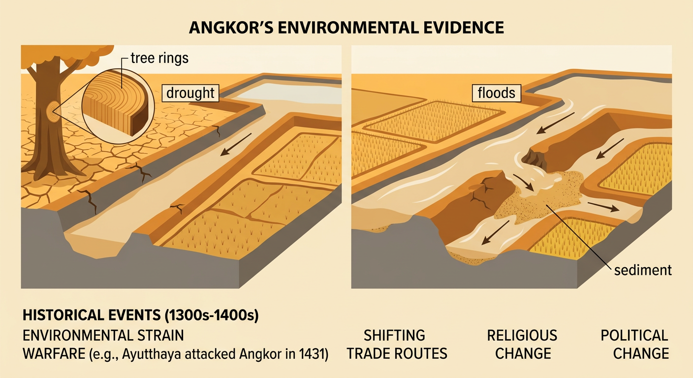
Angkor’s decline did not have a single cause. Environmental evidence from tree rings, lake sediments, and damaged waterworks indicates that the region experienced severe droughts interrupted by unusually intense monsoon rains during the 1300s and 1400s. Drought reduced available water, while powerful storms sent sudden floods and sediment through canals. A network designed for seasonal patterns became difficult to repair when extremes occurred repeatedly. For example, floodwater could erode a canal bank, deposit sand downstream, and block water from reaching another area. Environmental strain combined with warfare, changing trade routes, religious change, and shifts in political power. The city of Ayutthaya attacked Angkor in 1431, and Khmer political centers increasingly moved south. Angkor was not simply abandoned; people continued living and worshiping there. The evidence shows how a complex system can support a society yet become vulnerable when environmental and human pressures interact.