Biomes: Earth’s Major Life Zones
Students examine how climate, water, soil, plants, and animals define major terrestrial and aquatic biomes, including examples found in the United States.
Illustrations are auto-generated and may be placeholders. They can be refreshed to match the narration.
What Is a Biome?
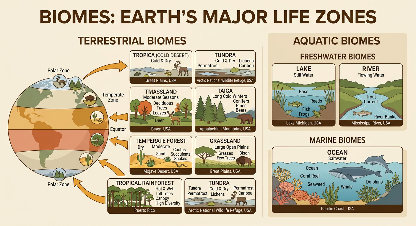
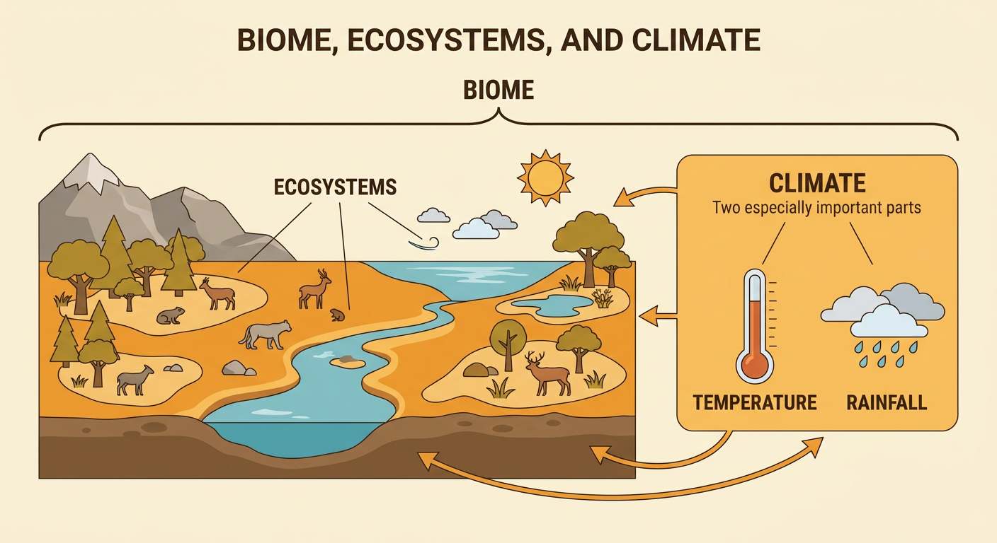
A biome is a large life zone with a particular climate and characteristic communities of plants and animals. Biomes may cover wide areas and include many smaller ecosystems. Climate, especially temperature and rainfall, strongly affects which organisms can survive there. For example, a tropical rainforest is warm and wet for most of the year, so it supports tall trees, climbing plants, insects, birds, and monkeys. A desert receives very little rain and has fewer plants, such as drought-resistant shrubs. Similar biomes can occur on different continents even though their species are not exactly the same. The United States contains several biomes, including temperate deciduous forest, grassland, desert, freshwater, and marine environments. Within each biome, living things interact with one another and with nonliving features such as water, air, sunlight, and soil.
Factors That Shape Biomes
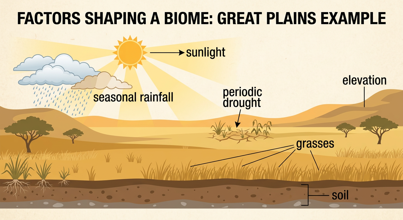
Biomes are shaped by several connected factors. Temperature and rainfall determine how much heat and water are available for life. Sunlight supplies energy for photosynthesis, while soil provides water and minerals to land plants. Soil may be sandy, clay-rich, shallow, deep, fertile, or poor in nutrients. Elevation also matters because higher places are usually cooler than nearby lowlands. Near oceans, water can make temperatures less extreme. Plants affect animals by providing food, shade, nesting places, and shelter. In turn, animals may pollinate flowers, spread seeds, or change vegetation by grazing. For example, the seasonal rainfall and periodic droughts of the Great Plains favor grasses and scattered drought-resistant trees rather than a dense temperate forest. No single factor acts alone; together, these conditions determine the biome that develops.
Major Terrestrial Biomes
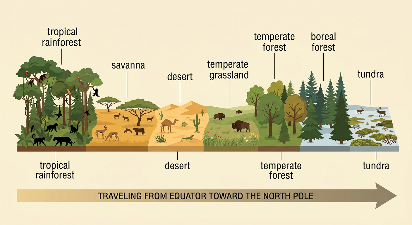
Terrestrial biomes are major life zones found on land. Tropical rainforests are hot and wet, with layered evergreen trees and very high biodiversity. Savannas are warm grasslands with scattered trees and distinct wet and dry seasons. Deserts receive very little rainfall, so plants and animals have adaptations for conserving water. Temperate grasslands have seasonal temperatures and are dominated by grasses, while temperate forests contain broad-leaved or needle-leaved trees. Boreal forests occur in cold northern regions and are dominated by conifers. Tundra is extremely cold, has a short growing season, and supports low plants such as mosses and lichens. For example, African savannas support grasses, acacia-like trees, antelopes, and grazing livestock. Each terrestrial biome has characteristic climate, vegetation, animals, and geographic distribution, although neighboring biomes may blend gradually.
Freshwater and Marine Biomes
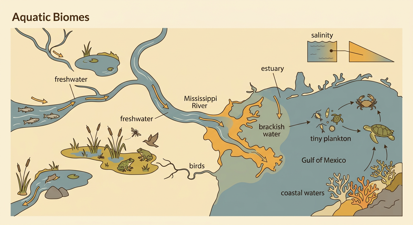
Aquatic biomes are water-based life zones. Freshwater biomes contain very little dissolved salt and include rivers, streams, lakes, ponds, and wetlands. Flowing rivers often contain fish adapted to currents, while wetlands support reeds, insects, frogs, birds, and other wildlife. America’s Mississippi River and Ohio River are important freshwater environments. Marine biomes contain salty water and include oceans, coral reefs, estuaries, and coastal waters. The Gulf of Mexico along the southern United States coast supports plankton, fish, crabs, sea turtles, and many other organisms. Estuaries form where river water mixes with seawater, creating brackish water. Mangrove trees can grow in some tropical estuaries because their roots tolerate salty, waterlogged soil. Water depth, light, temperature, movement, oxygen, and salinity help determine which organisms live in each aquatic habitat.
Biomes Found in the United States
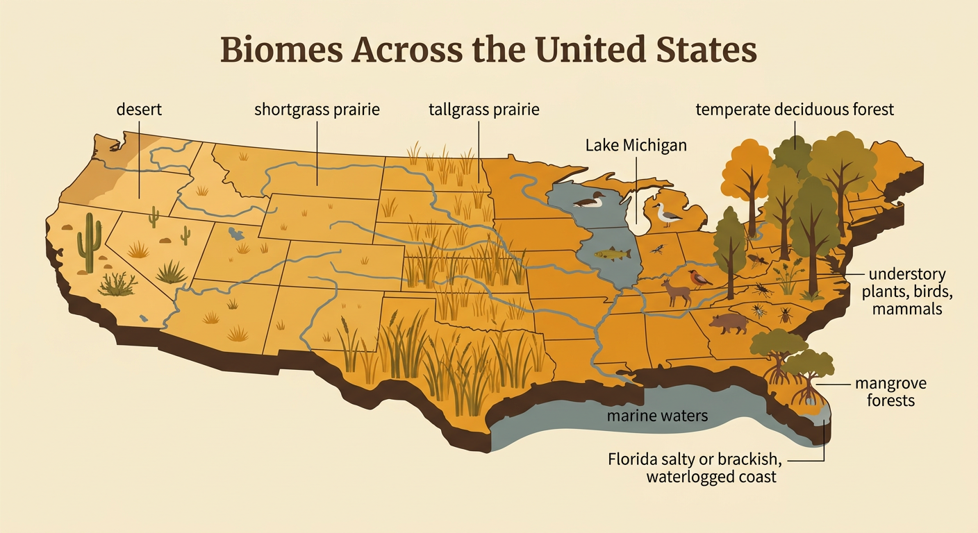
The United States’ biomes change dramatically across regions, from the humid coasts to the arid interior. Along the southern Atlantic and Gulf coasts, mangrove forests grow in salty or brackish, waterlogged areas such as the Florida Everglades. Farther inland across the East, temperate deciduous forest receives plentiful rainfall and supports tall trees, flowering understory plants, insects, birds, and mammals. Much of the central United States is covered by tallgrass prairie, where dense grasses grow across fertile plains. Moving west, shortgrass prairie has shorter grasses and fewer trees because rainfall is lower and dry periods are longer. The arid Southwest includes desert biomes, with sparse grasses and drought-resistant cacti and shrubs. The United States also has freshwater rivers, lakes, floodplains, and wetlands, as well as marine waters in the Gulf of Mexico. For example, Lake Michigan supports freshwater fish and water birds. Human activities can alter all these biomes.
Classifying Biomes by Their Features
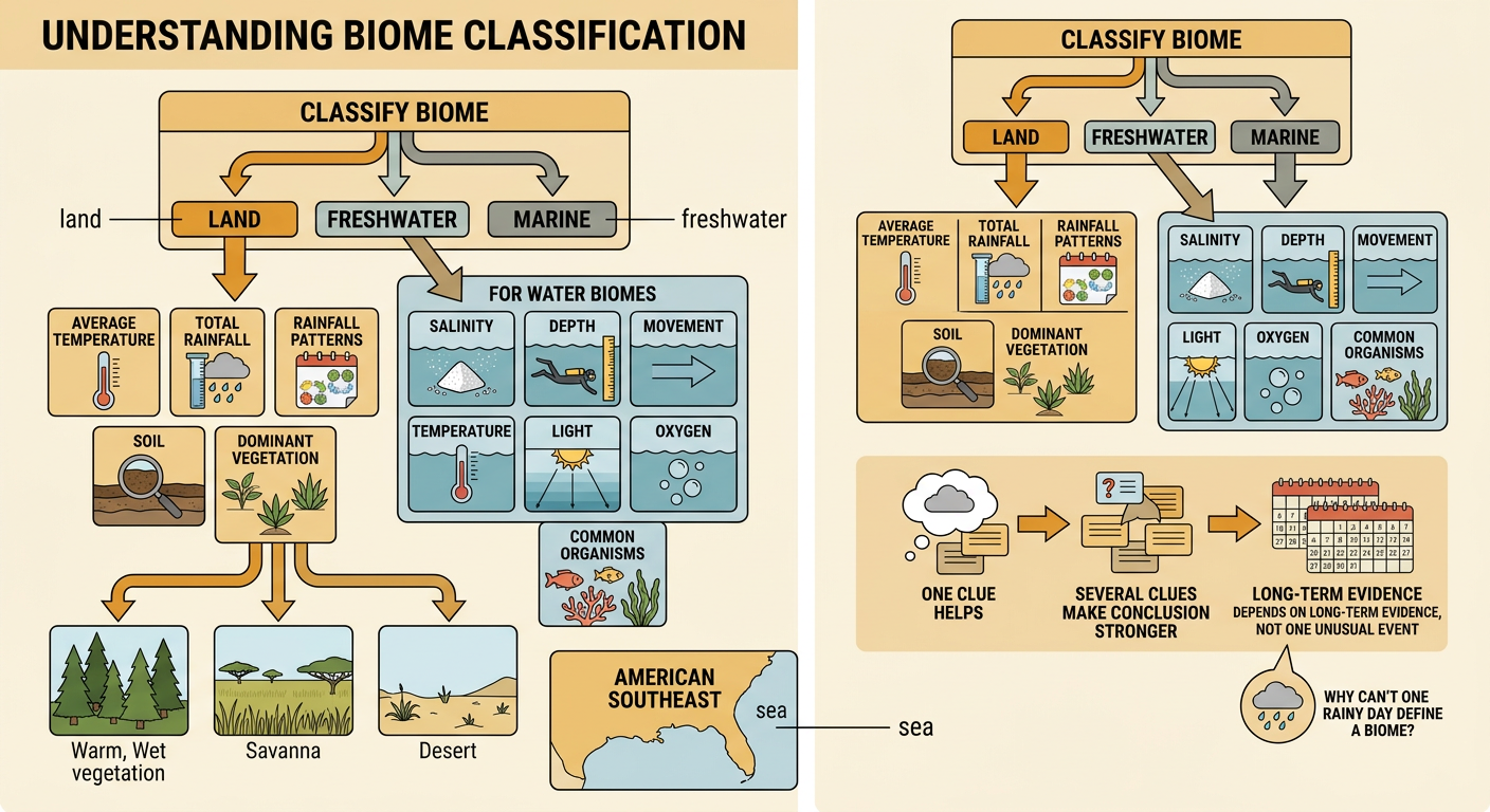
Scientists classify a biome by examining several features together. First, they decide whether the environment is mainly land, freshwater, or marine. For a land biome, they study average temperature, total rainfall, rainfall pattern, soil, and dominant vegetation. Tall evergreen trees usually indicate a warm, wet forest, while grasses with scattered trees suggest a savanna. Very low rainfall and sparse vegetation suggest a desert or semi-arid biome. For an aquatic biome, scientists measure salinity, depth, water movement, temperature, light, and oxygen. They also record common plants and animals. For example, a warm area in the American Southeast with seasonal rain, continuous grasses, and scattered drought-resistant trees can be classified as savanna. Classification should use long-term evidence because one rainy day or one unusual animal does not define an entire biome.