
Connected Habitats: Designing Wildlife Corridors
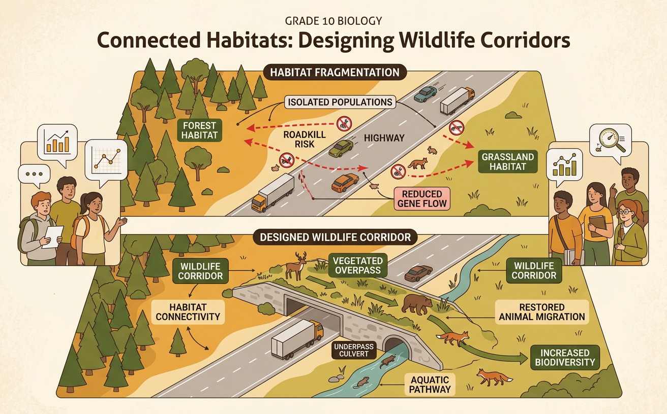
Students analyze evidence about habitat fragmentation and propose a wildlife corridor that reduces human impacts on biodiversity.
Illustrations are auto-generated and may be placeholders. They can be refreshed to match the narration.
Habitat Fragmentation in Focus
Habitat fragmentation occurs when a large, continuous habitat is divided into smaller, separated patches. Roads, farms, fences, dams, and housing developments can create barriers between feeding, breeding, and shelter areas. Fragmentation also produces edge habitat, where light, temperature, wind, predators, and invasive species may differ from conditions in the interior. For example, a new highway through a forest may separate a deer population from a seasonal feeding area. Deer attempting to cross face vehicle collisions, while deer that remain on one side have access to fewer resources and mates. Political zoning decisions and economic demand for transportation or housing often shape where development occurs. Scientists examine maps, field observations, and population data to identify how these human decisions affect habitat connections and biodiversity.

Reading a Species Movement Map
A species movement map shows where animals travel and which landscape features help or obstruct them. Begin by reading the title, legend, direction marker, and scale. Then locate habitat patches, roads, rivers, settlements, and recorded animal paths. Distinguish observations from inferences: a GPS point is recorded evidence, while a proposed travel route is an interpretation based on that evidence. For example, a map of elk locations may show many GPS points between a summer range and a winter range but few points near a four-lane highway. If several elk tracks end at the highway, the pattern supports the claim that the road is a movement barrier. When explaining the pattern, cite specific map evidence, such as the number, location, or concentration of points, rather than simply stating that the map “shows a problem.”

Effects on Populations and Biodiversity
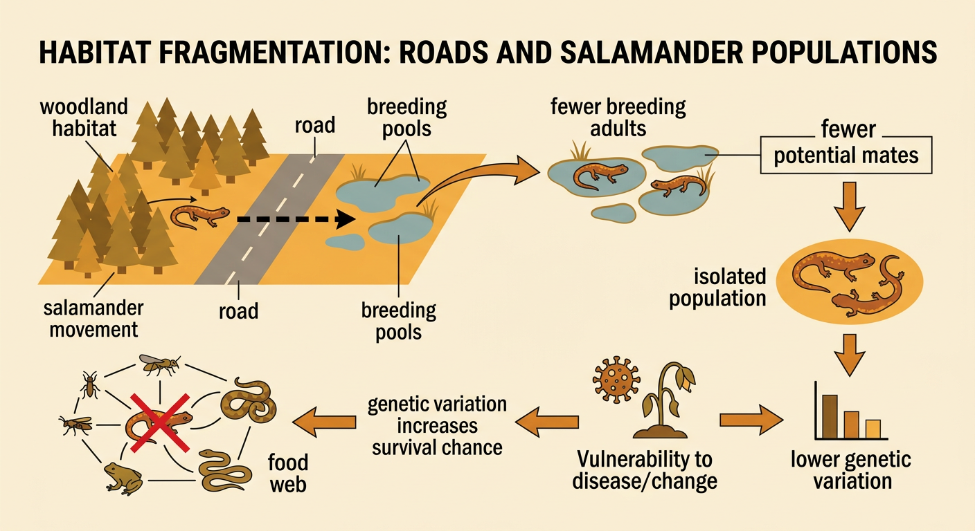
Fragmentation can reduce population size, limit access to resources, and isolate groups of the same species. Small, isolated populations may have fewer potential mates and less genetic variation. This can make them less able to respond to disease or environmental change. Barriers can also disrupt food webs when predators, pollinators, seed dispersers, or prey can no longer reach important habitats. For example, a road separating woodland salamanders from seasonal breeding pools may reduce the number of adults that reproduce each spring. Road deaths can further decrease the population. Over time, fewer salamanders may also affect organisms that eat them or are eaten by them. Not every species responds in the same way: some use habitat edges, while others require large interior areas. Scientists therefore compare evidence for several species before judging the overall effect on biodiversity.
Designing a Wildlife Corridor
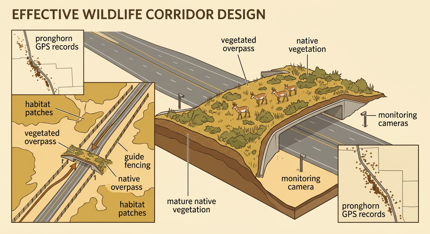
A wildlife corridor is a protected route that connects separated habitat patches. An effective design begins with measurable criteria, such as increasing safe crossings, preserving native vegetation, and serving multiple species. It must also address constraints, including cost, land ownership, road safety, and nearby development. Suppose GPS data reveal that pronghorn repeatedly approach the same section of fenced highway. A proposed solution could combine a wide vegetated overpass with fencing that guides animals toward it. The design should avoid steep slopes, bright lighting, and heavy human activity. Students can evaluate the plan by comparing its location with movement evidence and estimating how much habitat it connects. Monitoring cameras, track surveys, and collision records can test performance. If animals avoid the structure, the plan might be refined by widening the crossing, adding plant cover, or changing the guide fencing.
Defending the Conservation Plan
A strong conservation plan makes a clear claim, supports it with specific evidence, and explains why the evidence matters. For example, a team might claim that a vegetated overpass at Mile 18 is the best corridor location. Supporting evidence could include GPS records showing that 63 percent of documented pronghorn approaches occurred within one mile of that site, along with collision reports identifying the same road segment as a danger zone. The reasoning should connect those facts to the design: placing the crossing near an existing movement route is more likely to increase use and reduce collisions. The defense should also evaluate alternatives and tradeoffs. A cheaper tunnel may be too narrow for the target species, while rerouting the highway may cost more and affect local businesses. Students should explain how funding, land-use policy, community needs, and environmental goals influenced the final recommendation.
