Designing Wildlife Corridors to Protect Biodiversity
Students analyze habitat-fragmentation data and evaluate a wildlife-corridor proposal that could reduce human impacts on biodiversity.

Illustrations are auto-generated and may be placeholders. They can be refreshed to match the narration.
Habitat Fragmentation and Biodiversity
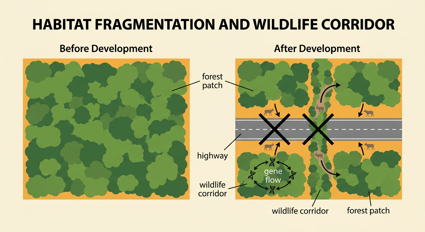
Habitat fragmentation occurs when a large, continuous habitat is divided into smaller, isolated patches by roads, farms, buildings, fences, or other land uses. Fragmentation can reduce biodiversity by shrinking available habitat, increasing dangerous habitat edges, and separating organisms from food, mates, and seasonal resources. Small populations may also lose genetic diversity because fewer individuals reproduce with one another. For example, a new highway may divide a forest used by black bears. Bears attempting to cross could be struck by vehicles, while bears that remain on one side may have access to fewer mates. A wildlife corridor can reconnect patches by providing a protected route between them. Corridors do not eliminate every effect of development, but they can improve movement, gene flow, and access to resources when their location and design match the needs of target species.
Reading the Landscape Map
A landscape map combines spatial information that can help planners locate barriers, habitat patches, and possible connections. Begin by reading the legend, scale, compass direction, and boundaries. Then compare layers showing vegetation, elevation, streams, roads, buildings, and protected land. For example, suppose a map shows two forest reserves separated by a highway and farmland. A wooded stream runs beneath the highway through an existing culvert. This route may be more suitable for a corridor than open farmland because it already provides cover and a possible crossing point. However, planners must also check whether the culvert is large enough, whether nearby traffic creates excessive noise, and whether private property would be affected. Map evidence should be combined with field observations and species-movement data rather than treated as complete proof that a route will work.

Analyzing Species-Movement Data
Species-movement data can reveal how strongly animals respond to habitat conditions. Researchers might record corridor width as the explanatory variable and the number of successful animal crossings per month as the response variable. Plotting each site on a scatterplot makes the relationship visible. For example, five monitored routes may have widths of 20, 40, 60, 80, and 100 meters and average 3, 7, 11, 15, and 18 successful crossings per month. The upward pattern suggests a positive association: wider routes tend to have more crossings. A line of best fit can summarize the trend and support predictions, while unusual points should be investigated. The association does not prove that width alone causes movement. Vegetation cover, traffic, season, species behavior, and monitoring effort may also affect the results. Sample size and data quality must be considered before making a design decision.

Designing a Wildlife Corridor
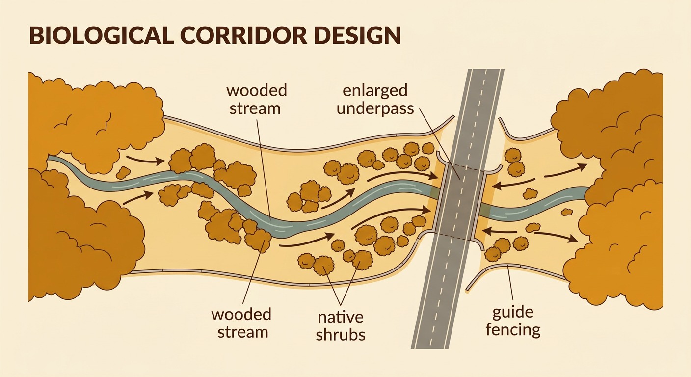
A corridor design should meet biological criteria while respecting geographic and human constraints. First, identify target species and determine their movement needs, including minimum width, vegetation, water access, and preferred crossing structures. Next, compare possible routes using map and movement data. For example, a corridor for deer, bobcats, and small mammals might follow a wooded stream between two reserves, pass through an enlarged highway underpass, and include native shrubs for cover. Fencing beside the highway could guide animals toward the underpass and reduce vehicle collisions. Designers should avoid steep slopes, bright lighting, heavy recreation, and narrow bottlenecks when evidence shows these features discourage movement. The proposal should include measurable goals, such as increasing successful crossings by 40 percent within three years. Monitoring cameras, track surveys, and roadkill counts can test whether the corridor works and guide later improvements.
Evaluating Trade-Offs and Impacts
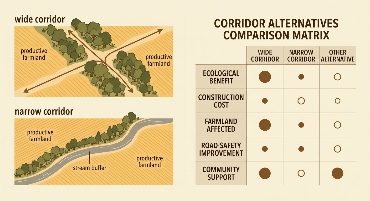
Every corridor proposal has benefits, costs, and possible unintended effects. Ecological benefits may include greater movement, gene flow, access to food, and recovery after fires or droughts. Social and economic costs may include land purchases, construction, maintenance, changes to farming, or limits on future development. For example, widening a corridor from 50 to 100 meters may improve animal movement but remove productive farmland and increase the project budget. A narrower route using an existing stream buffer might cost less, although it could serve fewer species. Planners should compare alternatives with consistent criteria, such as expected crossings, habitat quality, cost, road safety, feasibility, and effects on nearby communities. They should also seek input from landowners, Tribal Nations, conservation groups, transportation agencies, and residents. Collective action can provide funding and coordination, while individual actions, such as controlling pets and supporting native vegetation, can reduce local disturbance.
Evidence-Based Recommendation
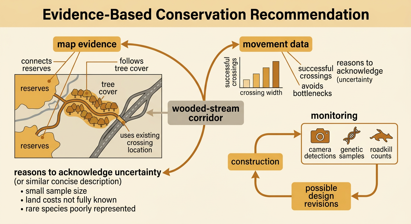
An evidence-based recommendation makes a clear claim, supports it with multiple sources, and explains why the evidence matters. A strong recommendation might state: Build the wooded-stream corridor with an enlarged highway underpass and guide fencing. The landscape map supports this route because it connects both reserves, follows existing tree cover, and uses a current crossing location. Movement data also show a positive association between corridor width and successful crossings, supporting a design that maintains adequate width. The recommendation should acknowledge limitations, such as a small sample size, uncertain land costs, or limited data for rare species. It should also describe monitoring and revision. For example, agencies could compare camera detections, genetic samples, and roadkill counts before and after construction. If crossings remain low, managers could add vegetation, reduce lighting, modify fencing, or widen bottlenecks. This process turns the proposal into a testable, adaptable solution rather than a permanent assumption.