Geography and the Rise of River Valley Civilizations
Students analyze maps and historical evidence to explain how rivers, fertile land, and natural resources shaped the development of early civilizations.
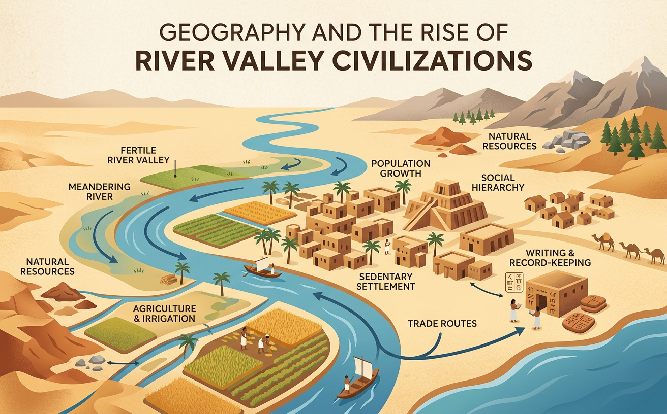
Illustrations are auto-generated and may be placeholders. They can be refreshed to match the narration.
Locating the River Valleys
Early civilizations developed near major rivers in several regions of Africa and Asia. Mesopotamian cities arose between the Tigris and Euphrates Rivers in Southwest Asia. Egyptian civilization grew along the Nile River in northeastern Africa. Cities of the Indus civilization developed near the Indus River and its tributaries in South Asia. Early Chinese states formed around the Huang He, or Yellow River, and later expanded toward the Yangtze River. Location mattered because rivers connected settlements, supplied fresh water, and deposited sediment that could support farming. For example, the Nile flows north through a desert to the Mediterranean Sea. Its narrow floodplain provided productive land in an otherwise dry environment. However, geography influenced rather than completely determined development; people made choices about irrigation, settlement, trade, and government.

Environmental Opportunities and Risks
River valleys offered important opportunities, but they also created environmental risks. Rivers supplied drinking water, fish, transportation routes, and water for crops. Seasonal floods could spread nutrient-rich sediment across floodplains, renewing the soil. Flooding was not equally predictable everywhere. The Nile usually rose on a seasonal cycle, while floods along the Tigris and Euphrates could be more irregular and destructive. The Huang He carried large amounts of sediment, which raised its riverbed and contributed to severe floods when levees failed. Communities responded by building canals, reservoirs, embankments, and drainage systems. These projects required labor and cooperation, but they could also increase conflict over access to water. For example, Mesopotamian farmers used irrigation to grow crops in a dry climate, yet poor drainage sometimes caused salt to accumulate in fields and reduce harvests.

Agriculture and Permanent Settlements
Reliable food production helped small farming villages grow into permanent settlements and cities. Farmers planted crops suited to local conditions, including wheat and barley in Mesopotamia and Egypt, cotton and grains in the Indus region, and millet in northern China. Irrigation and floodplain farming could produce a surplus, meaning more food than farming families immediately needed. Stored surplus supported population growth and allowed some people to work as builders, merchants, soldiers, officials, priests, or craftspeople. Permanent settlements then required systems for storing grain, organizing labor, resolving disputes, and protecting water supplies. In Mesopotamia, for example, cities such as Ur depended on surrounding fields and irrigation canals. Farmers supplied grain, while urban craftspeople produced pottery, tools, and textiles. This relationship connected the physical system of land and water with the human systems of trade, government, labor, and social organization.

Comparing Early Civilizations
The river valley civilizations shared some geographic advantages, but each developed under different environmental conditions. Egypt had a narrow, fertile Nile floodplain bordered by deserts, which limited farmland but also created natural barriers. Mesopotamia had broad plains with few defensive barriers, and its cities depended heavily on irrigation from the Tigris and Euphrates. Indus cities such as Mohenjo-daro included planned streets and extensive drainage systems, evidence that residents managed water in a densely settled environment. In northern China, communities farmed fertile loess soil near the Huang He, but erosion and heavy sediment increased flood danger. These differences influenced settlement patterns, engineering, trade, and political organization. Still, environmental conditions alone cannot explain every feature of a civilization. Cultural traditions, leadership, technology, warfare, and contact with neighboring peoples also shaped historical outcomes. Comparison therefore requires identifying both shared patterns and important differences.

Evidence-Based Geographic Conclusions
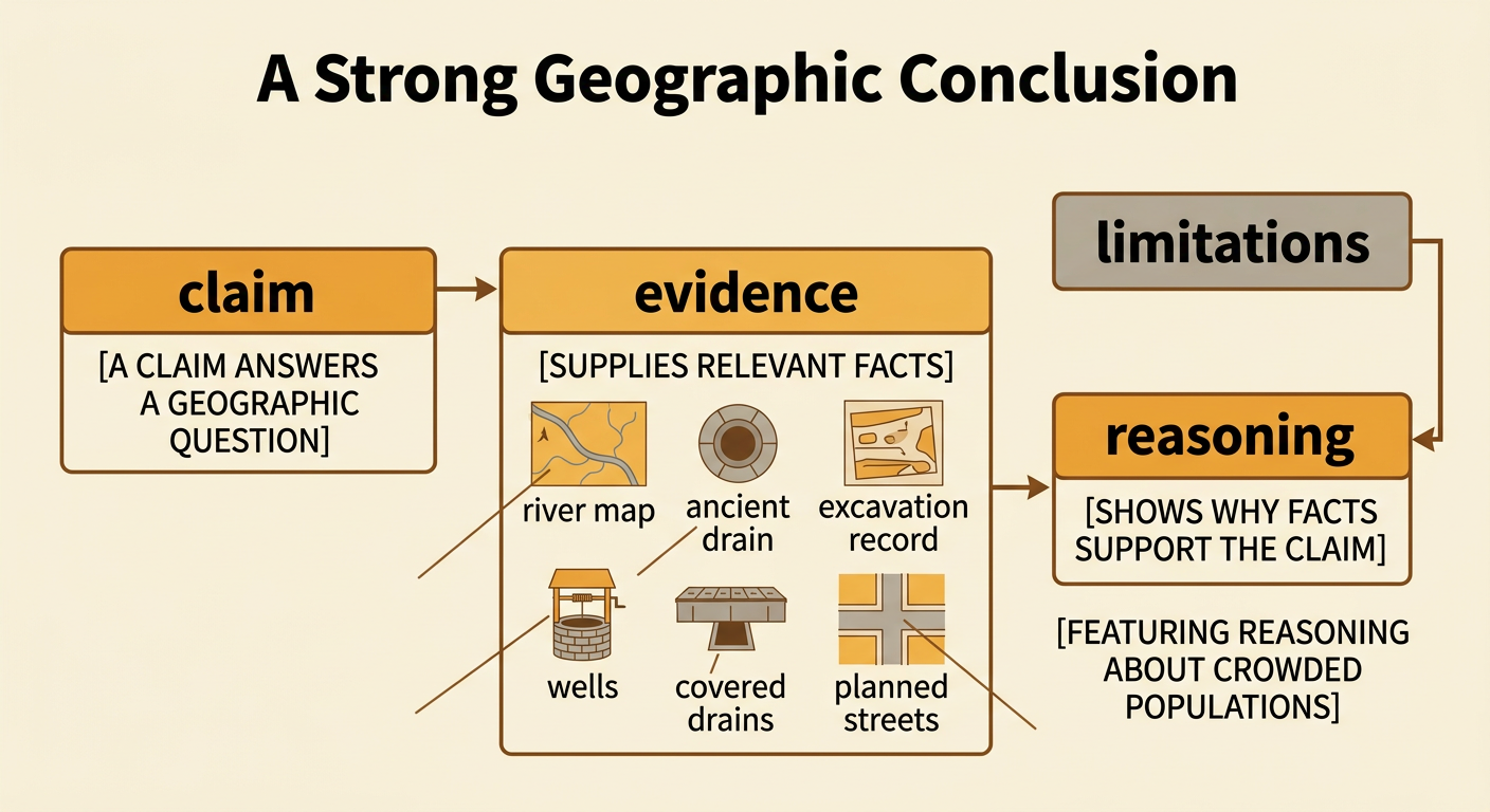
A strong geographic conclusion connects a clear claim to specific evidence and explains the connection. Students should examine primary sources, such as artifacts, ancient texts, settlement remains, and irrigation structures, alongside secondary sources written by historians and archaeologists. Maps can reveal where settlements stood in relation to rivers, farmland, deserts, or trade routes. For example, a student might claim that water management supported urban growth in the Indus civilization. Evidence could include the wells, covered drains, and carefully planned streets found at Mohenjo-daro. The reasoning should explain that these features helped residents obtain water and remove wastewater in a crowded city. Evidence also has limits. Archaeological remains may be incomplete, and a map may show location without proving why people made a decision. Effective conclusions cite precise details, compare multiple sources, and avoid claiming that geography was the only cause of change.