Geography, Resources, and New Imperialism
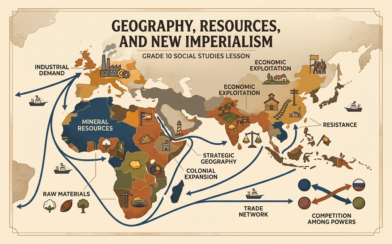
Students analyze maps, trade data, and historical sources to explain how natural resources, industrial demand, and strategic geography shaped nineteenth-century imperialism and its effects on colonized societies.
Illustrations are auto-generated and may be placeholders. They can be refreshed to match the narration.
Defining New Imperialism
New Imperialism was the rapid expansion of European, U.S., and Japanese control over territories in Africa, Asia, and the Pacific during the late nineteenth and early twentieth centuries. Imperial powers used military force, treaties, investment, and colonial governments to gain political and economic control. This movement differed from earlier coastal trading empires because industrial states increasingly claimed large inland territories and directly governed their populations. Several causes worked together: competition among powerful nations, industrial demand for resources and markets, strategic concerns, missionary activity, and racist ideas used to justify domination. For example, during the Berlin Conference of 1884–1885, European representatives established rules for claiming African territory without including African leaders. Geography and technology helped imperial powers act on these ambitions, but colonized peoples continued to negotiate, adapt, and resist.

Mapping Empires and Strategic Locations
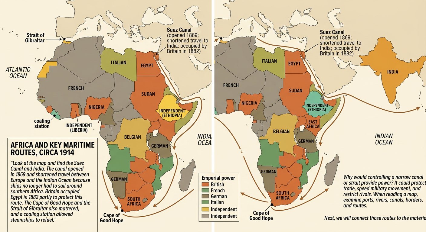
Maps reveal that imperial powers valued location as well as resources. By 1914, European states controlled most of Africa, while Ethiopia and Liberia remained independent. Britain sought a chain of ports and territories connecting the British Isles, India, and East Asia. The Suez Canal, opened in 1869, shortened the sea route between Europe and the Indian Ocean by eliminating the need to sail around southern Africa. Britain occupied Egypt in 1882 partly to protect this route and its access to India. Other strategic locations included the Cape of Good Hope, the Strait of Gibraltar, and coaling stations where steamships could obtain fuel. When analyzing an imperial map, students should examine ports, rivers, canals, borders, and transportation routes. These geographic features help explain why some places became centers of international rivalry or military control.
Industrial Demand for Raw Materials
Industrial economies required large and dependable supplies of raw materials. Factories used cotton for textiles, rubber for electrical insulation and tires, copper for wiring, palm oil for soap and machinery, and coal for steam power. These demands encouraged governments and businesses to seek control over resource-rich regions. In the Congo Free State, ruled personally by King Leopold II of Belgium until 1908, agents forced many communities to collect wild rubber as worldwide demand increased. In British-ruled India, raw cotton was exported to industrial centers, while British manufactured cloth was sold in Indian markets. Climate and physical geography affected where valuable resources could be produced: tropical conditions supported rubber and palm oil, while particular soils and rainfall patterns favored cotton. Resources did not automatically cause conquest, but their location became important when combined with technology, investment, military power, and competition among industrial states.

Evidence from Trade Data and Primary Sources
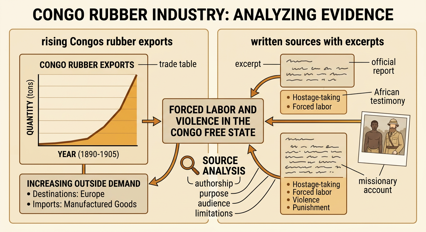
Historians combine quantitative evidence with written or visual sources. Trade tables can show changes in the amount or value of raw materials exported, the destinations of exports, and the kinds of manufactured goods imported. For example, rising rubber exports from the Congo during the late nineteenth-century rubber boom indicate growing outside demand, but the numbers alone do not reveal how rubber was collected. Reports by missionaries, African testimony, official investigations, and photographs describe hostage-taking, forced labor, violence, and punishment under Leopold's system. Each source must be evaluated for authorship, purpose, audience, and limitations. An official report might minimize abuses, while a reform campaign could emphasize the most shocking cases. When several independent sources agree and match the trade pattern, the explanation becomes stronger. Students should distinguish what the data directly show from conclusions that require additional evidence.
Effects on Colonized Societies
Imperial rule produced political, economic, social, and environmental effects that varied across regions. Colonial governments removed or limited local sovereignty, imposed taxes, and redirected labor toward mines, plantations, and export agriculture. Railroads and ports were often built to move resources from inland areas to the coast, although local people also used this infrastructure for travel and commerce. Cash-crop production could create income for some farmers but also reduce land available for food production and increase vulnerability when prices fell or drought occurred. Colonial borders divided some communities and combined others within new states. Mission schools and colonial institutions expanded certain forms of education while often weakening local languages or authority. People did not respond in one way. For example, Ethiopians defeated an Italian invasion at the Battle of Adwa in 1896, while other societies used petitions, strikes, migration, cultural preservation, or armed resistance.

Evidence-Based Historical Explanation
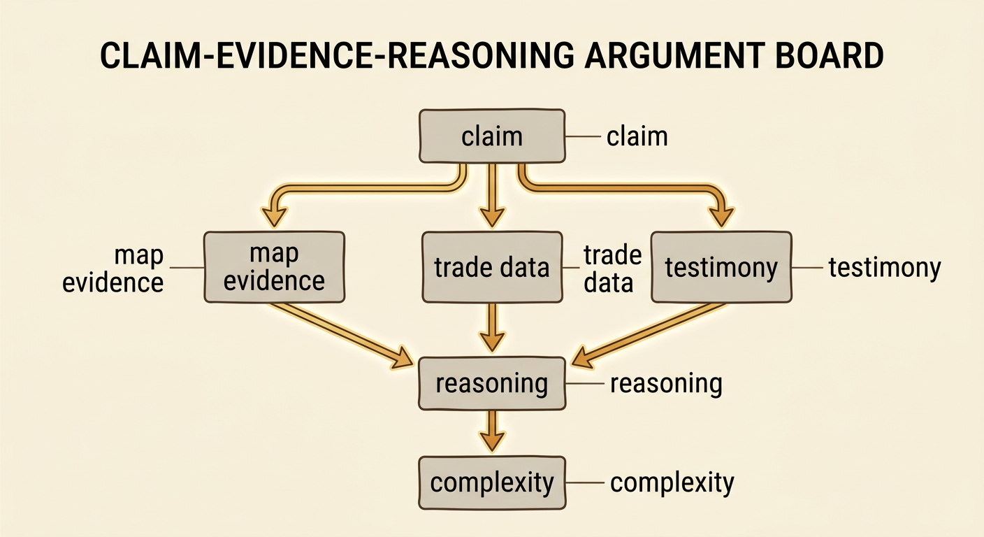
An evidence-based explanation presents a clear claim, supports it with relevant evidence, and explains how the evidence demonstrates cause and effect. A strong claim might state that industrial demand encouraged imperial expansion, while strategic geography shaped which territories powers targeted and how they controlled them. Evidence could include a map of British influence along the route to India, trade data showing increased exports of rubber or cotton, and testimony describing colonial labor systems. The reasoning should connect these sources: factories increased demand, control of ports and canals protected transportation, and colonial policies organized land and labor to expand exports. The explanation should also recognize complexity. National rivalry, military technology, racism, and local political conditions contributed alongside resources and geography. Finally, it should identify effects on colonized societies and note differences among regions. Addressing a competing explanation, such as national prestige alone, makes the argument more convincing.