How Geography Shaped the Colonial Regions
Students compare maps and informational texts to explain how geography and natural resources influenced life and work in the New England, Middle, and Southern Colonies.

Illustrations are auto-generated and may be placeholders. They can be refreshed to match the narration.
Locate the Thirteen Colonies
The thirteen British colonies stretched along the Atlantic coast of North America. Mapmakers often group them into three regions. New England included New Hampshire, Massachusetts, Rhode Island, and Connecticut. The Middle Colonies were New York, New Jersey, Pennsylvania, and Delaware. The Southern Colonies were Maryland, Virginia, North Carolina, South Carolina, and Georgia. The Atlantic Ocean bordered the colonies on the east, while the Appalachian Mountains formed a major inland feature to the west. Rivers connected inland settlements with coastal ports. For example, the Delaware River helped people and goods move between Philadelphia and nearby farming areas. When reading a map, use the title, compass rose, legend, and scale to understand location and distance. Regional boundaries are useful for comparison, although environments also varied within each colony.

Compare Climate and Landforms
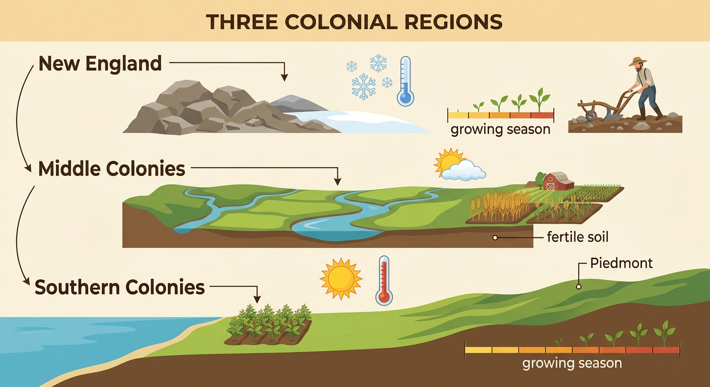
Climate and landforms differed from north to south. New England generally had cold winters, mild summers, rocky soil, hills, and a shorter growing season. The Middle Colonies had a moderate climate, broad river valleys, and many areas of fertile soil. The Southern Colonies had warmer temperatures, a longer growing season, wide coastal plains, and inland rolling hills called the Piedmont. These patterns affected what colonists could grow, but conditions were not identical everywhere within a region. For example, New England’s rocky ground made large farms difficult in many places. In Pennsylvania, fertile valleys supported fields of wheat and other grains. In Virginia and Maryland, the warm climate and long growing season supported tobacco farming. A climate map and a landform map provide different evidence, so comparing both gives a fuller picture of each region.
Identify Regional Natural Resources
Natural resources are useful materials found in the environment. New England had forests, fish, whales, natural harbors, and fast-moving streams. Timber provided wood for homes and ships, while the Atlantic supported fishing. The Middle Colonies had fertile soil, forests, rivers, and some iron deposits. Farmers used the rich soil to grow wheat, corn, and other crops. The Southern Colonies had fertile coastal soils, forests, long rivers, and a warm climate. Colonists grew tobacco in the Chesapeake region and rice and indigo in parts of the southern coastal lowlands. Crops were cultivated products, but their growth depended on natural resources such as soil, water, and sunlight. For example, South Carolina’s warm, wet lowlands supported rice cultivation. A resource map uses symbols to show where resources are concentrated and helps explain why certain activities developed in particular places.

Connect Geography to Jobs and Trade
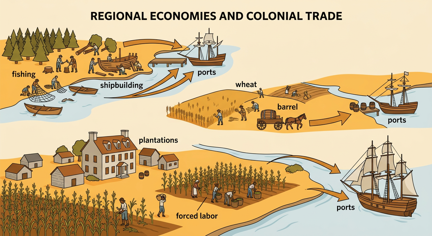
Geography influenced where people worked and how goods moved. In New England, forests, harbors, and access to the Atlantic supported fishing, shipbuilding, woodworking, and overseas trade. In the Middle Colonies, fertile farms produced large amounts of wheat and other grains, while ports such as New York and Philadelphia connected farmers with markets. In the Southern Colonies, the long growing season supported tobacco, rice, and indigo production. Large plantations developed in some areas, especially near rivers that carried crops to ports. Enslaved Africans performed much of the forced labor on many Southern plantations, and slavery also existed in the other regions. For example, barrels of wheat could travel from a Pennsylvania farm to Philadelphia and then leave by ship. Geography created opportunities, but people’s choices, laws, labor systems, and trade relationships also shaped each regional economy.
Explain Regional Differences
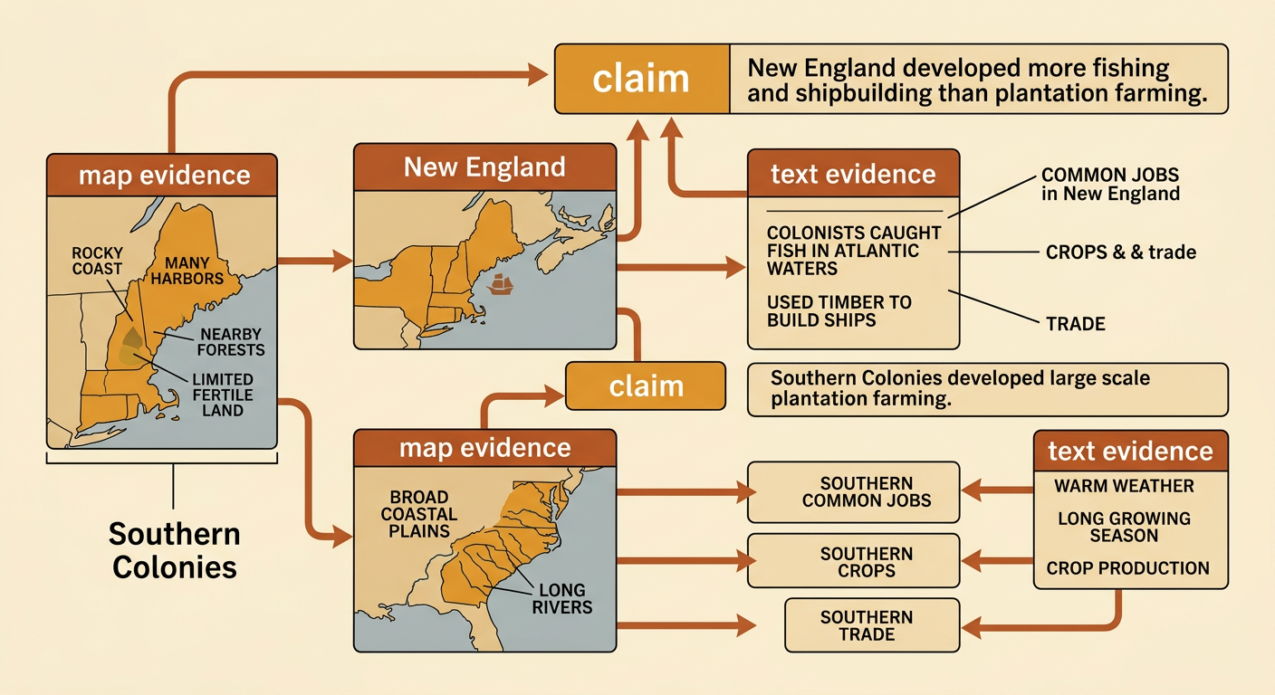
To explain regional differences, combine evidence from maps with details from informational texts. First, identify a geographic pattern, such as colder temperatures in the north or a longer growing season in the south. Next, connect that pattern to resources, work, and trade. A strong explanation includes a claim and specific evidence. For example, a student might claim that New England developed more fishing and shipbuilding than plantation farming. Map evidence shows a rocky coastline, many harbors, nearby forests, and limited fertile land. Text evidence explains that colonists used timber to build ships and caught fish in Atlantic waters. In contrast, maps of the Southern Colonies show broad coastal plains and long rivers, while texts describe a warm climate and crop production. Geography did not control every decision, but it strongly influenced the opportunities available in each region.