
How Geography Shaped the Economies of the Thirteen Colonies
Students compare the New England, Middle, and Southern Colonies to explain how climate, land, waterways, and natural resources influenced work, trade, agriculture, and settlement.

Illustrations are auto-generated and may be placeholders. They can be refreshed to match the narration.
The Three Colonial Regions
The thirteen British colonies along the Atlantic coast were often grouped into three regions. New England included New Hampshire, Massachusetts, Rhode Island, and Connecticut. The Middle Colonies were New York, New Jersey, Pennsylvania, and Delaware. The Southern Colonies were Maryland, Virginia, North Carolina, South Carolina, and Georgia. Each region had different climates, landforms, waterways, and natural resources. These environmental characteristics helped shape where people settled and how they earned a living. For example, New England’s rocky soil and many harbors encouraged fishing and shipping, while the broad, fertile land of the Middle Colonies supported large grain harvests. Geography did not decide every human choice, but it created opportunities and challenges that influenced each regional economy.

Climate, Land, and Waterways
Climate, land, and water interacted to shape colonial life. New England had cold winters, a short growing season, and much thin, rocky soil. Farther south, warmer temperatures created longer growing seasons. The Middle Colonies had fertile valleys and plains, while parts of the Southern Colonies had wide coastal plains suited to certain crops. Waterways connected inland farms and forests to coastal towns. Rivers supplied fresh water, powered some mills, and carried goods toward ports. Natural harbors allowed ships to load and unload cargo safely. For example, a Pennsylvania farmer could send barrels of flour down the Delaware River to Philadelphia, where merchants sold or shipped them. This shows how land, water, climate, plants, animals, and people formed an interacting system.

New England: Fishing and Trade
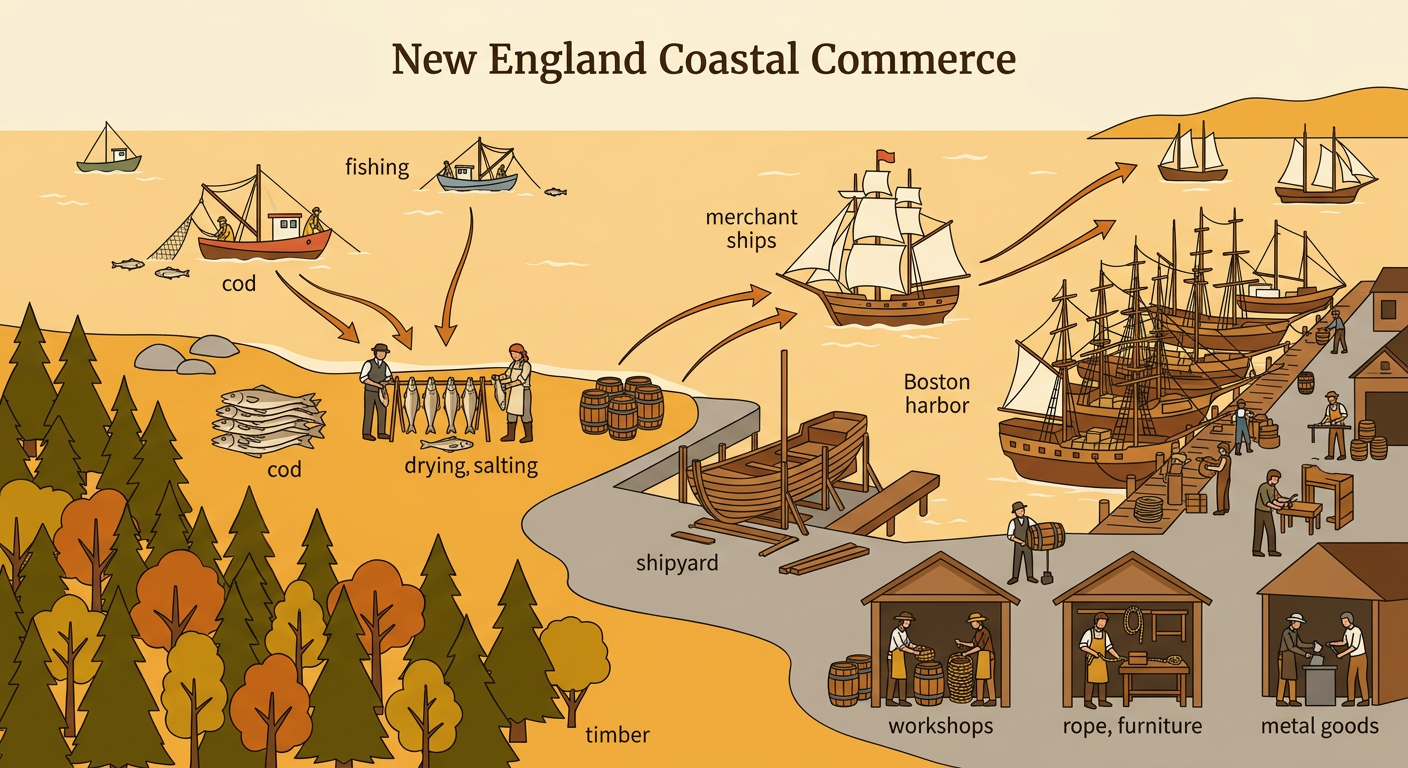
New England’s cold climate and short growing season limited large-scale farming, although families still raised crops and animals. Much of the soil was thin and rocky. At the same time, the region had forests, natural harbors, and access to rich Atlantic fishing grounds. Colonists caught cod and other fish, cut timber, built ships, and traded through ports such as Boston and Newport. Merchants exchanged fish, lumber, farm products, and imported goods with other colonies and places across the Atlantic. Skilled workers also made barrels, rope, furniture, and metal goods. For example, workers could catch cod offshore, dry and salt the fish near the harbor, pack it in barrels, and load it onto a merchant ship. Geography encouraged coastal settlement and an economy strongly connected to the sea.
Middle Colonies: Farms and Rivers
The Middle Colonies had moderate climates, longer growing seasons than New England, and areas of deep, fertile soil. Farmers produced large amounts of wheat, corn, rye, and other crops, so the region became known as the “breadbasket” of the colonies. Many farms also raised cattle, pigs, and sheep. Rivers such as the Hudson and Delaware helped settlers move people and goods between inland areas and ports. Flour mills were often built near flowing water, and roads connected farms to river landings. Philadelphia and New York grew into busy trading centers. For example, wheat harvested on a Pennsylvania farm could be taken to a mill, ground into flour, placed in barrels, and transported to Philadelphia for sale. Fertile land and navigable waterways supported both farming and commerce.

Southern Colonies: Cash Crops and Enslaved Labor
The Southern Colonies generally had warm climates, long growing seasons, and broad coastal plains. These conditions supported cash crops, which were grown mainly for sale. Tobacco became important in Maryland and Virginia, while rice and indigo were major crops in parts of South Carolina and Georgia. Rivers allowed planters to ship crops from inland plantations to Atlantic ports. Southern society also included many small farms, towns, craftspeople, and merchants. Plantation owners demanded a large labor force and increasingly used the forced labor of enslaved Africans and African Americans. Enslavement was a human system created and enforced through violence and laws; it was not an automatic result of geography. For example, enslaved workers cultivated tobacco in Virginia, prepared it for market, and loaded barrels onto riverboats, while owners took the profits from their labor.

Compare the Regional Economies
The three regional economies developed differently because their environmental characteristics created different opportunities. New England’s rocky land, forests, harbors, and nearby fishing grounds supported fishing, shipbuilding, crafts, and ocean trade. The Middle Colonies’ fertile soil, moderate climate, and major rivers supported grain farming, milling, livestock raising, and trade through large ports. The Southern Colonies’ warm climate, long growing season, coastal plains, and navigable rivers supported tobacco, rice, and indigo production. Labor systems and human decisions also mattered, especially the expansion of slavery in the South. The regions were connected rather than separate. For example, a New England ship might carry Middle Colonies flour or Southern tobacco to another port. Comparing these cause-and-effect relationships helps explain why settlements, jobs, and trade networks differed across colonial America.
