How Inca Engineering Helped Build an Empire
Students examine maps, scale drawings, and historical evidence to explain how Inca roads, bridges, and terraces strengthened and connected their empire.
Illustrations are auto-generated and may be placeholders. They can be refreshed to match the narration.
The Inca Empire and Its Challenges
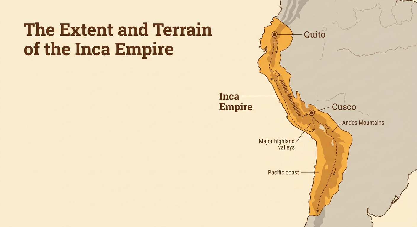
At its height in the early 1500s, the Inca Empire stretched about 2,500 miles along western South America. Its territory included coastal deserts, deep valleys, high plateaus, and steep Andes Mountains. These landforms made travel, farming, and communication difficult. The empire also contained millions of people who spoke different languages and followed different local customs. Inca leaders governed from Cusco and needed ways to move officials, workers, soldiers, messages, and supplies across this varied territory. For example, traveling between Cusco and Quito required crossing mountains and rivers over a distance of more than 1,000 miles. The Inca responded with connected systems of roads, bridges, storehouses, and terraces. Engineering did not create the empire by itself, but it helped leaders overcome geographic challenges and govern distant communities.
Roads Across the Andes
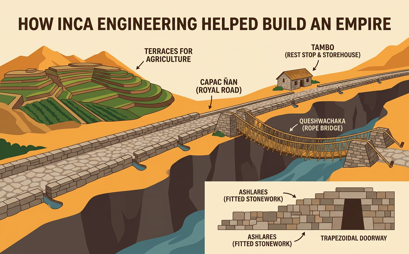
The Inca built and improved a road system called the Qhapaq Ñan, or Royal Road, totaling roughly 25,000 miles. Routes followed mountain ridges, crossed deserts, and connected settlements throughout the empire. Inca engineers adapted each section to local conditions. They built stone paving on some routes, stairs on steep slopes, retaining walls beside drop-offs, and drainage channels where heavy rain could damage the road. Rest stations called tambos provided shelter and supplies. Relay runners called chasquis carried spoken messages and quipus, recording devices made from knotted cords. For example, one chasqui could run a section of road and then pass a message to the next runner at a relay station. This system moved information much faster than one person could travel the entire distance. Roads also helped armies and government officials reach distant provinces.

Suspension Bridges and Terraces
Rivers and steep slopes required specialized designs. Inca communities built suspension bridges from braided plant-fiber ropes anchored to stone supports. Several large cables formed the bridge floor, while other ropes served as handrails. Because plant fibers weakened over time, local communities regularly rebuilt the bridges. On mountain slopes, farmers constructed terraces supported by stone retaining walls. Terraces created flatter fields, reduced soil erosion, and helped control water. Some terraces included layers of soil, sand, and stone that improved drainage. At Machu Picchu, terraces helped stabilize slopes as well as provide growing space. Each design solved a different problem: bridges allowed movement across gaps, while terraces supported farming and protected hillsides. Engineers evaluating these solutions could compare strength, available materials, labor needs, drainage, and durability rather than choosing a design based on only one feature.

Reading Maps and Scale Drawings
Maps and scale drawings help historians measure Inca engineering instead of relying only on written descriptions. A map scale shows the relationship between a distance on the page and the actual distance on Earth. Suppose a road map uses the scale 1 centimeter equals 50 kilometers. If two Inca sites are 7.2 centimeters apart along a straight map line, their estimated real-world separation is 360 kilometers because 7.2 times 50 equals 360. A scale drawing can also represent a structure. At a scale of 1 centimeter equals 2 meters, a bridge drawn 6 centimeters long represents a bridge 12 meters long. Students must check units and remember that a straight-line map measurement may be shorter than an actual mountain road. Combining measurements with elevation symbols and historical evidence gives a more accurate explanation of travel challenges.

Engineering, Communication, and Imperial Power
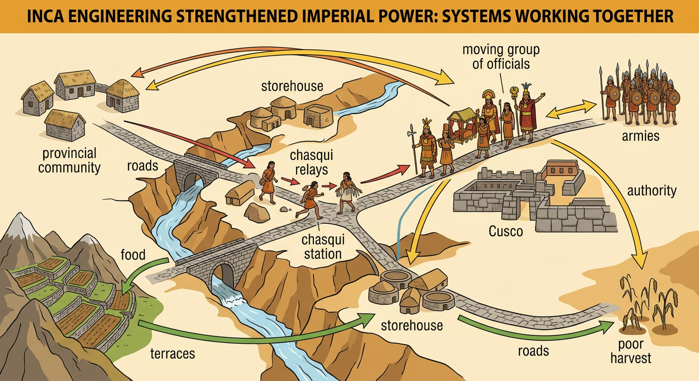
Inca engineering strengthened imperial power by connecting transportation, communication, food production, and government. Roads and bridges allowed officials and armies to move between provinces. Chasqui relays carried information, while roadside storehouses held food, clothing, tools, and military supplies. Terraces increased usable farmland and could reduce damage from erosion. For example, if one region experienced a poor harvest, officials could use roads and storehouses to move supplies from another region. These systems had several causes, including difficult geography, the need for food, and the challenge of governing distant peoples. They also had multiple effects: faster communication, increased trade and movement, stronger government control, and greater labor demands on local communities. Historians combine road remains, bridge foundations, terraces, artifacts, and Spanish written accounts to study these effects. They also consider each source’s purpose and viewpoint before drawing conclusions.