How Navigation Shaped European Exploration of the Americas
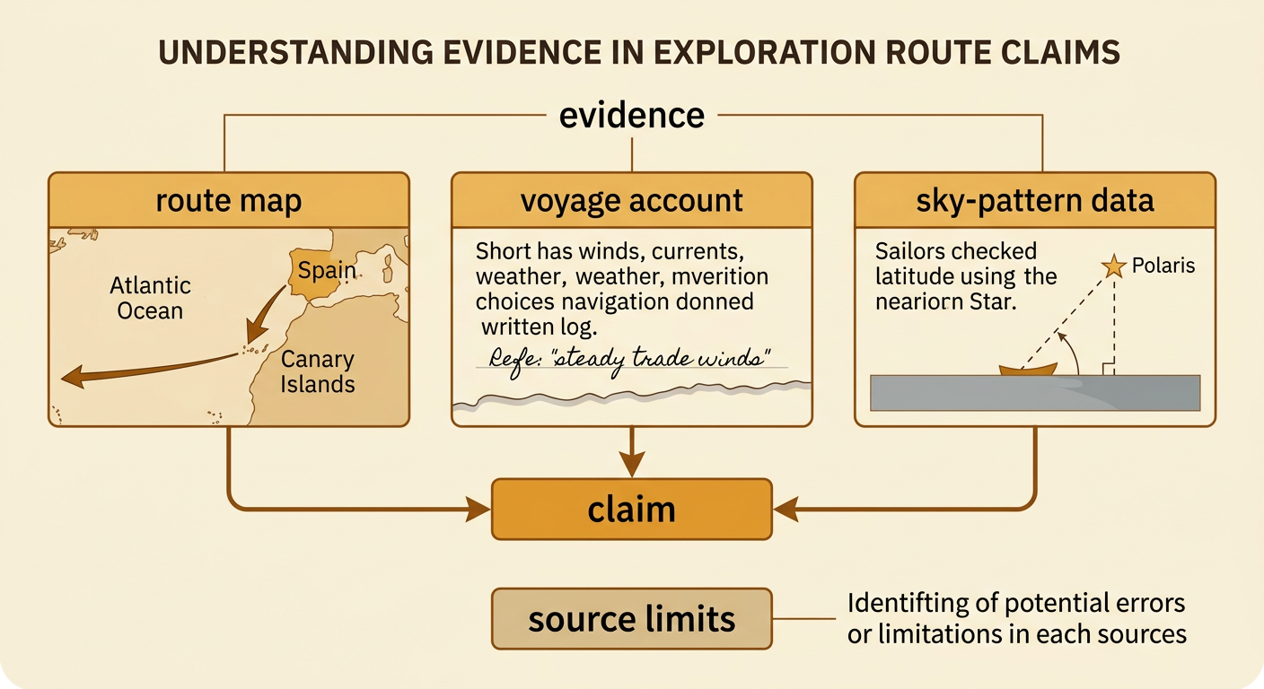
Students analyze maps, voyage accounts, and patterns in the night sky to explain how navigation influenced European exploration routes and encounters with Indigenous peoples.
Illustrations are auto-generated and may be placeholders. They can be refreshed to match the narration.
Motives for European Exploration
During the 1400s and 1500s, European rulers and merchants wanted new sea routes to Asian markets. Spices, silk, and other valuable goods were expensive because they traveled through many trading networks. European kingdoms also competed for wealth, territory, and political power. Some explorers and rulers hoped to spread Christianity. These motives encouraged governments to pay for long, dangerous voyages. For example, Spain supported Christopher Columbus’s 1492 voyage because he claimed he could reach Asia by sailing west. Instead, he reached Caribbean islands where Indigenous peoples already lived. European goals influenced which voyages received money, which lands explorers claimed, and how Europeans described the people they encountered. Exploration was therefore connected to trade, competition, religion, and colonization—not simply curiosity about unknown places.

Maps and Early Navigation Tools
Navigators combined maps with several tools, but none provided a perfectly accurate position. Portolan charts showed coastlines, ports, compass directions, and lines used to plan courses. A magnetic compass helped sailors maintain a direction even when clouds hid the sky. A log line and sandglass helped crews estimate speed, while written records tracked distance and direction through dead reckoning. An astrolabe or cross-staff could help estimate latitude. Longitude was much harder to measure accurately during early Atlantic exploration. For example, a navigator might sail west by compass, estimate each day’s distance, and mark the ship’s supposed location on a chart. Small errors in speed, currents, or direction could grow over many days. As a result, maps guided exploration, but incomplete information and measurement errors sometimes changed where ships arrived.

Using the Sun and Stars
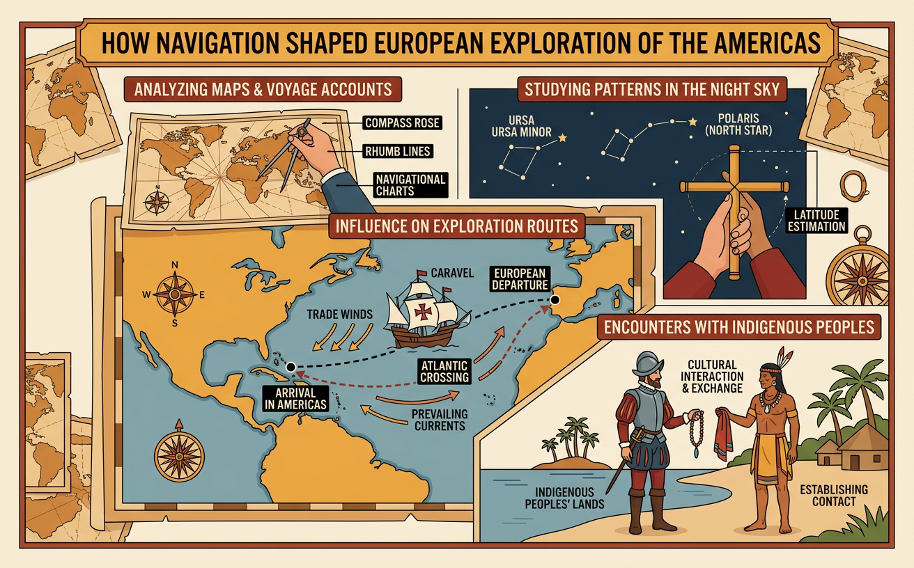
Sailors observed repeating patterns in the sky to estimate direction and latitude. In the Northern Hemisphere, Polaris, the North Star, appears nearly fixed above north while other stars seem to move around it during the night. The angle of Polaris above the horizon is close to the observer’s latitude. For example, if Polaris appears about 30 degrees above the horizon, the ship is near 30 degrees north latitude. Navigators also measured the Sun’s height near noon and compared the measurement with tables for the date. Daily observations showed the Sun rising generally in the east and setting generally in the west. Seasonal records showed that the Sun’s noon height and the visible constellations changed during the year. These predictable patterns helped sailors check direction and remain near a chosen latitude, although clouds and rough seas could prevent accurate observations.
Tracing Major Exploration Routes
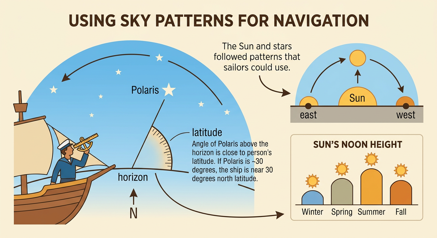
Exploration routes were shaped by navigation knowledge, winds, currents, coastlines, and voyage goals. In 1492, Columbus sailed southwest from the Canary Islands, using steady Atlantic trade winds to reach the Caribbean. For the return, his ships traveled farther north to find winds that generally blew eastward toward Europe. In 1497, John Cabot crossed the colder North Atlantic from England and reached the northeastern coast of North America. Beginning in 1519, the Magellan expedition followed South America’s Atlantic coast, passed through a narrow strait near the continent’s southern end, and entered the Pacific. Magellan died in the Philippines, but other crew members completed the first circumnavigation. When students place these routes on one map, patterns become visible: departure ports, wind belts, land barriers, and desired destinations all affected where ships traveled and which Indigenous societies Europeans encountered.
Encounters with Indigenous Peoples
Navigation did more than move ships across oceans; it shaped where Europeans first met Indigenous peoples. Each route reached communities with their own governments, languages, trade networks, and knowledge of the environment. When Columbus’s expedition arrived in the Caribbean, the crew encountered Taíno communities. Taíno people provided food, information, and local guidance, while Europeans recorded descriptions from their own limited and often biased viewpoints. Later encounters brought trade and cultural exchange, but they also led to violence, forced labor, land seizure, colonization, and deadly diseases to which Indigenous peoples had little immunity. Indigenous communities responded in many ways, including negotiation, resistance, relocation, and alliance-building. To understand an encounter fairly, students should compare European voyage accounts with Indigenous perspectives, maps, oral histories, and archaeological evidence rather than relying on a single explorer’s report.

Evidence-Based Route Explanation
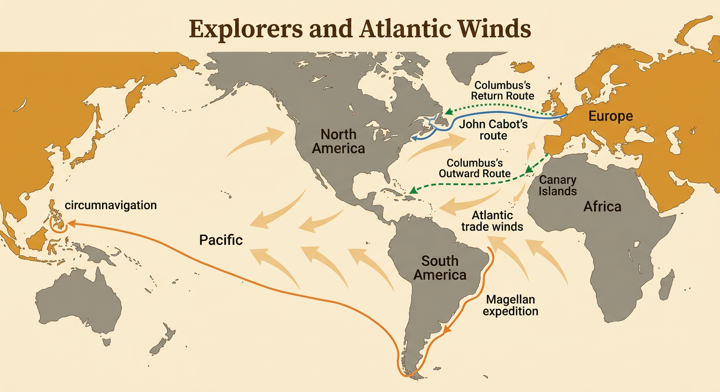
A strong route explanation makes a claim and supports it with evidence from several sources. Begin with a route map to identify direction, distance, coastlines, and stopping places. Next, examine a voyage account for observations about winds, currents, weather, or navigation decisions. Then use sky-pattern data to explain how sailors checked direction or latitude. For example, a student might claim that Columbus’s fleet sailed southwest before turning west because the route reached the Canary Islands and then used Atlantic trade winds. Map arrows provide geographic evidence, while a voyage entry about steady winds provides written evidence. A diagram of Polaris can explain how latitude was checked. The student should also note limits: a European account may omit Indigenous perspectives, and an old map may contain errors. Combining sources produces a more reliable explanation than using one source alone.