Mapping Patterns in Earth's Features
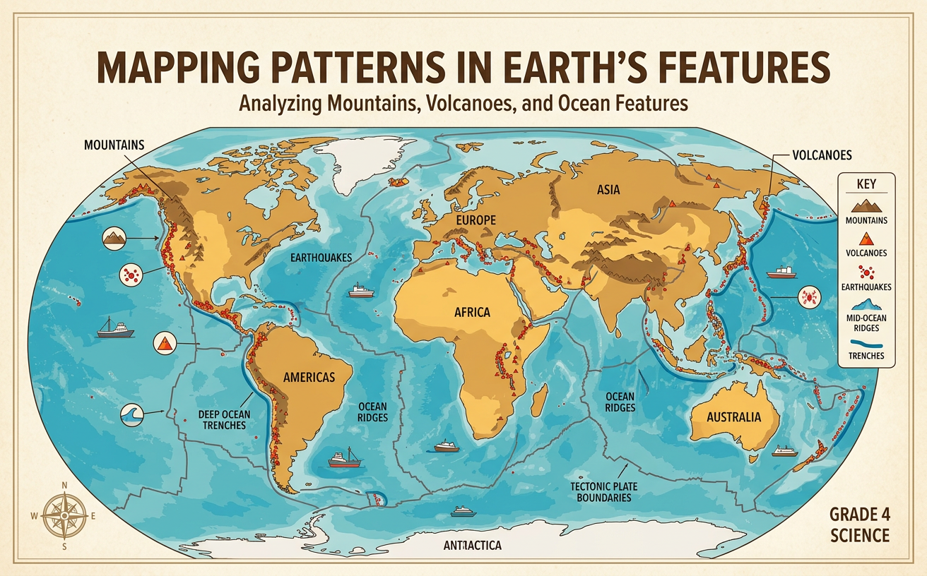
Students analyze physical maps to identify patterns in the locations of mountains, volcanoes, earthquakes, and ocean features.
Illustrations are auto-generated and may be placeholders. They can be refreshed to match the narration.
Reading a Physical Map
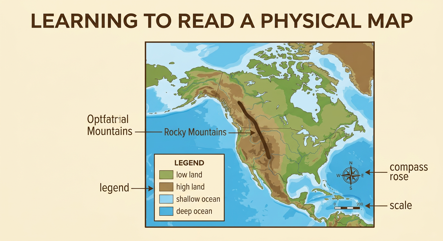
A physical map shows natural features of Earth, such as land elevation, mountains, rivers, oceans, and deep seafloor areas. Begin by reading the map title and legend. The legend explains what each color, line, and symbol represents. A compass rose shows direction, while a scale helps estimate real distances. On many maps, green marks lower land, brown marks higher land, and shades of blue show ocean depth. However, always check the legend because map colors can vary. For example, a band of dark brown in western North America represents the high elevations of the Rocky Mountains. It does not mean the land is actually brown. Use several map clues together before drawing a conclusion about a place.
Locating Major Earth Features
Earth’s major features can be located by using continents, oceans, directions, and map grids as reference points. Mountain ranges include the Andes along western South America and the Himalayas north of India. Many volcanoes are located around the edges of the Pacific Ocean. Earthquake locations are often shown as dots, while volcanoes may be marked with triangles. Important ocean features include the Mid-Atlantic Ridge, an underwater mountain chain near the middle of the Atlantic Ocean, and the Mariana Trench in the western Pacific Ocean. For example, to describe the Andes precisely, say that they form a long north-south chain near the western coast of South America. This description is more useful than simply saying the mountains are “on the left” because map orientation or projection can change.

Finding Geographic Patterns
A geographic pattern is a repeated arrangement that can be seen across a map. Look for features that form lines, chains, clusters, rings, or wide scattered areas. Mountains, volcanoes, and earthquakes are not evenly spread across Earth. Many occur in long bands near the edges of continents or oceans. Around much of the Pacific Ocean, volcanoes and earthquakes form a broad ring-shaped pattern called the Ring of Fire. Along western South America, the Andes Mountains form a chain near many volcanoes and earthquake locations. Ocean maps also show long underwater ridges and narrow trenches. Not every feature fits the main pattern. For example, the Hawaiian volcanoes form an island chain far from a continent’s edge. Recognizing both the main pattern and exceptions makes a map analysis more accurate.

Comparing Map Evidence
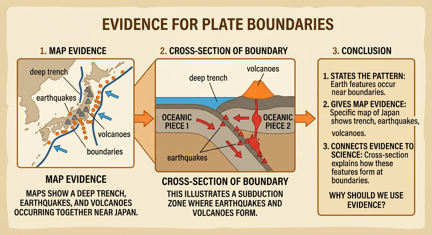
One map may show elevation, while another shows volcanoes, earthquakes, or ocean depth. Comparing maps helps reveal relationships that are difficult to notice on only one map. First, make sure the maps show the same region and have similar orientation. Then compare the locations using coastlines, latitude and longitude lines, or grid squares. Imagine that one map shows a deep ocean trench east of Japan and another shows many earthquake dots in the same grid squares. Their overlap is evidence that the trench and frequent earthquakes occur near one another. You can also use numbers to describe the evidence. For example, if eight of ten grid squares along a mapped mountain belt contain earthquake symbols, the concentration is stronger than in nearby squares with none. Counts, distances, and locations turn visual observations into evidence.

Explaining Observed Patterns
A strong explanation states the pattern, gives map evidence, and connects the evidence to what scientists know about Earth. Earth’s outer layer is broken into enormous moving pieces. Many mountains, volcanoes, earthquakes, ridges, and trenches occur near the boundaries between these pieces. For example, maps show a deep trench, many earthquakes, and a curved chain of volcanoes near Japan. This repeated overlap suggests that the features are related rather than randomly located. Underwater ridges also form long mountain chains where parts of the seafloor move apart. Use careful language such as “the maps show,” “the evidence suggests,” or “many features occur.” Avoid saying that every volcano or earthquake is found in the same kind of location. A complete explanation includes the main pattern, a specific example, and any important exception.