
Monsoons and Life in Ancient India
Students use maps and climate evidence to explain how seasonal monsoons shaped agriculture, settlement, trade, and daily life in ancient India.
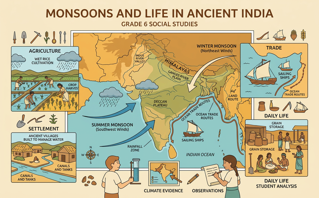
Illustrations are auto-generated and may be placeholders. They can be refreshed to match the narration.
Locating Ancient India
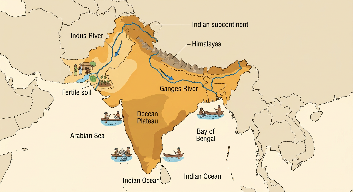
Ancient India developed across the Indian subcontinent, a large land area that includes present-day India, Pakistan, Bangladesh, and nearby regions. The Himalayas form a high barrier to the north, while the Arabian Sea, Indian Ocean, and Bay of Bengal surround much of the subcontinent. The Indus River flows through the northwest, and the Ganges River crosses the northern plains. Farther south lies the elevated Deccan Plateau. These physical features affected climate, travel, farming, and settlement. For example, many early communities grew near the Indus River because river water and fertile soil supported crops in an otherwise fairly dry region. Coastal locations also gave people access to fishing and sea trade. Ancient political borders changed over time, so physical features are often more useful than modern borders for studying the region.
What Causes a Monsoon?
A monsoon is a seasonal change in prevailing wind direction that often creates a wet season and a dry season. During summer, land on the Indian subcontinent heats faster than the nearby ocean. Warm air rises over the land, creating lower air pressure. Moist air then moves inland from the Indian Ocean and releases rain as it rises and cools, especially near mountains. Earth's rotation helps curve these moving winds, creating broad circulation patterns. During winter, the land cools faster than the ocean. Higher pressure forms over the cooler land, and generally drier winds blow toward the sea. For example, a coastal city such as Mumbai receives much of its yearly rain during the summer monsoon rather than evenly throughout the year. Monsoons are seasonal wind systems, not single storms.

Reading a Seasonal Rainfall Map
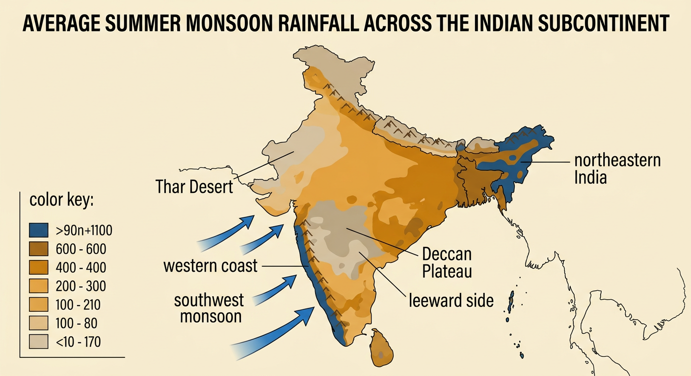
A seasonal rainfall map uses colors or shading to show how much rain different places receive during a certain period. Begin by reading the title, dates, direction arrow, and color key. Then compare areas rather than assuming the whole subcontinent has the same climate. During the summer monsoon, the western coast and parts of northeastern India receive very heavy rainfall. The Thar Desert in the northwest receives much less. Some interior parts of the Deccan Plateau are also drier because mountain ranges force moist air to rise and drop rain before it reaches the leeward side. For example, if dark blue represents more than 80 inches of seasonal rain and tan represents less than 10 inches, the map provides evidence that farmers in those areas faced very different water conditions. Rainfall totals should also be compared with the timing of rain.
Monsoons, Farming, and Settlements
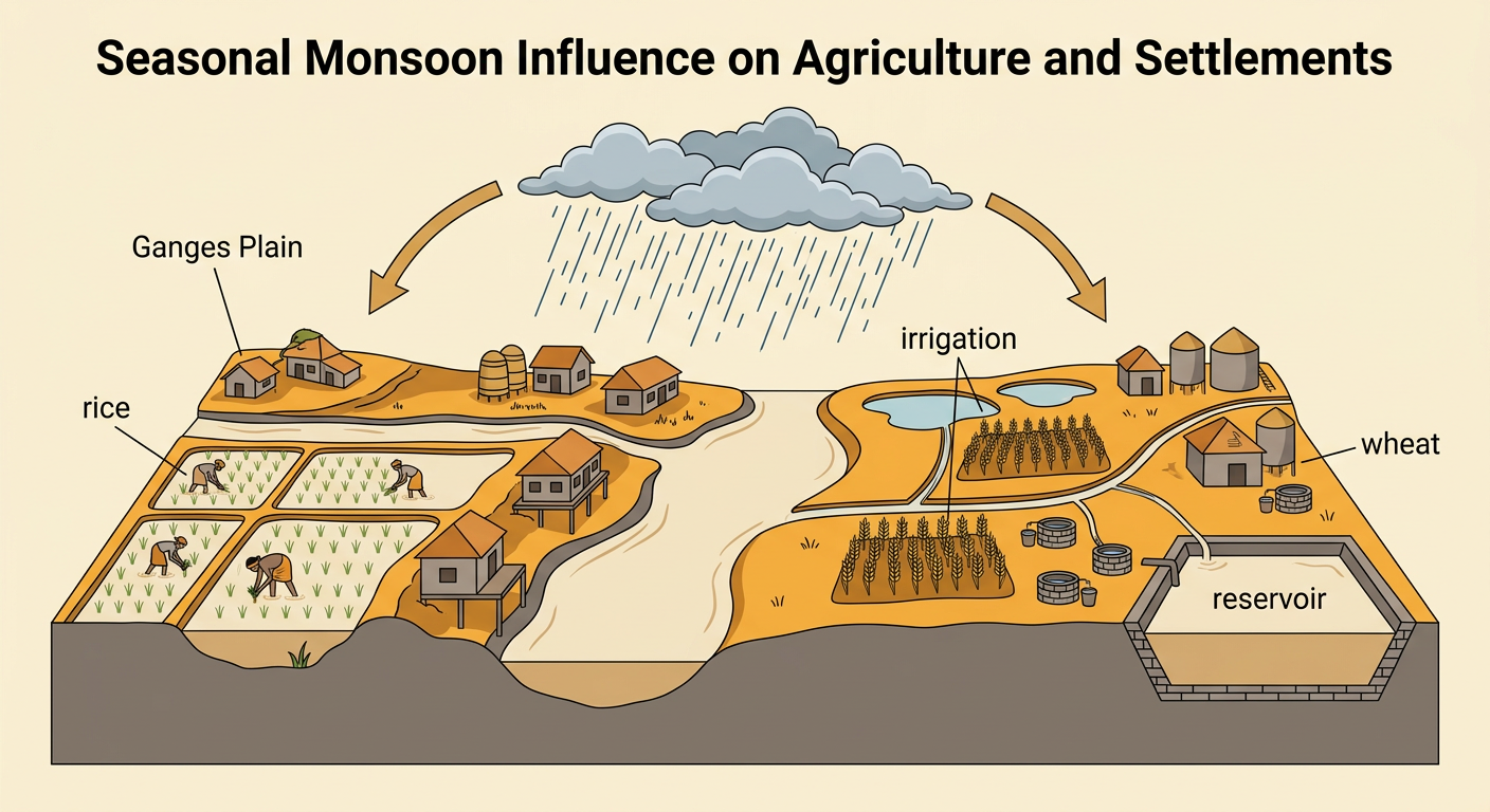
Seasonal rain strongly influenced what ancient farmers planted, when they worked, and where communities grew. In wetter areas of the Ganges Plain, summer rain supported water-demanding crops such as rice. In drier northwestern areas, farmers also depended on rivers, wells, floodwater, and irrigation to grow wheat and barley. People often built settlements near dependable water sources, but they had to consider the danger of flooding. Communities stored grain and managed water through wells, channels, ponds, and reservoirs. The timing of the monsoon mattered as much as the total amount of rain. For example, rain arriving near the start of the growing season could soften soil and supply young rice plants. A late or weak monsoon could reduce harvests. These conditions encouraged people to develop local farming methods rather than use one system across the entire subcontinent.
Benefits and Risks of Seasonal Rains
Monsoon rains brought both opportunities and dangers. Reliable rain watered fields, filled wells and reservoirs, renewed pasture, and increased river flow. Good harvests could produce extra grain for storage or trade. Seasonal winds also supported Indian Ocean trade because sailors learned that wind directions usually changed between summer and winter. Merchants could plan outward and return voyages around those patterns. However, heavy rain could flood rivers, damage homes, wash away soil, and spread waterborne disease. Too little rain could cause crop failure, food shortages, and competition for water. For example, a village might benefit when moderate rain filled its reservoir, but suffer if unusually intense rain broke an embankment and flooded stored grain. People reduced risk by storing food, maintaining drainage and waterworks, planting different crops, and combining farming with herding, craft production, or trade.

Explaining Geography's Influence
To explain geography's influence, connect a geographic condition to evidence, human choices, and results. Start with a claim, use a map or climate model as evidence, and explain why the evidence supports the claim. For example: Seasonal monsoon rainfall encouraged dense farming settlements in parts of the Ganges Plain. A rainfall map shows substantial summer rain there, while a physical map shows a broad river plain. Together, these features provided water and relatively fertile land for crops such as rice. People responded by building villages, managing water, storing grain, and exchanging surplus food. This does not mean geography controlled every decision. Knowledge, technology, government, beliefs, and trade also shaped daily life. A strong explanation therefore uses phrases such as influenced, encouraged, limited, or created opportunities instead of claiming that climate alone determined what ancient people did.
