
Resources, Geography, and Early Trade Networks
Students analyze maps and brief historical sources to explain how the uneven distribution of natural resources shaped settlement, trade routes, and cultural exchange in early societies.
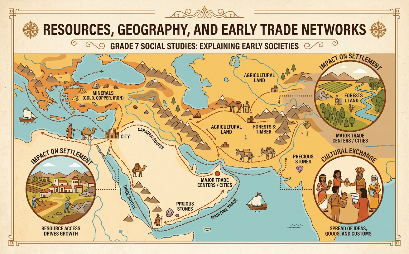
Illustrations are auto-generated and may be placeholders. They can be refreshed to match the narration.
Resource Distribution Map Warm-Up
A resource map shows where useful materials and water were concentrated. Begin by reading the title, date, scale, compass rose, and map key. Then describe patterns before explaining them. For example, a map of the eastern Mediterranean and Southwest Asia might show copper on Cyprus, cedar forests in Lebanon, obsidian in Anatolia, and dependable river water along the Nile. These resources were unevenly distributed because geological processes formed minerals in certain rocks, while climate and landforms affected forests and freshwater. No single settlement had easy access to everything it needed. Compare resource locations with nearby rivers, coasts, and settlements. A strong observation states what the map shows: “Major settlements appear near water, but important minerals are located in different regions.” An explanation then connects that pattern to settlement or trade.

Geography and Settlement Patterns
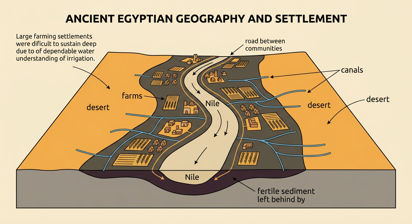
Geography influenced where early people could obtain water, grow food, build homes, and travel. River valleys often attracted dense settlements because rivers supplied freshwater and deposited fertile sediment on floodplains. Mountains, deserts, and dry plateaus usually supported fewer large farming settlements, although they could contain valuable stone, metals, or grazing land. Ancient Egyptian communities provide a clear example. Most settlements and fields developed close to the Nile because rainfall was limited and the surrounding desert was extremely dry. Seasonal flooding renewed some farmland, while the river supported transportation between communities. This pattern did not mean that geography completely controlled human choices. People built canals, wells, roads, and storage systems to adapt to local conditions. Settlement patterns therefore resulted from both the distribution of natural resources and the technologies people used to reach or manage them.
Mapping Early Trade Routes
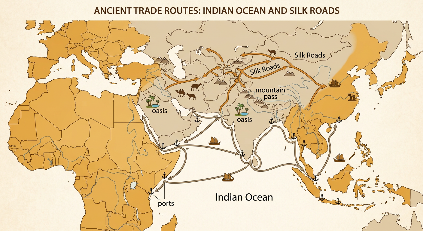
Trade routes connected settlements that had different resources. To analyze a route map, identify the starting points, destinations, physical barriers, and transportation methods. Rivers and seas could move heavy cargo more efficiently than overland travel, while mountain passes and desert oases guided land routes. Around the ancient Indian Ocean, merchants used boats to link ports in East Africa, Arabia, India, and Southeast Asia. Overland routes across Central Asia later became part of the Silk Roads, carrying silk, horses, metals, and other goods between regions. Improved ships, pack animals, roads, and navigation expanded the distance and amount of trade. As connections grew, ports and caravan stops could become important settlements. Routes were not single unchanging lines; they shifted with seasons, political conditions, available technology, and access to water. Use arrows on a map to explain both movement and direction.
Reading Evidence of Cultural Exchange
Trade moved more than raw materials and finished goods. Travelers also carried languages, religious beliefs, artistic styles, technologies, and scientific knowledge. Historians look for evidence of this exchange in artifacts, buildings, images, and written accounts. For example, Buddhist art from Gandhara, in present-day Pakistan and Afghanistan, sometimes shows the Buddha wearing robes with folds that resemble styles used in Greek and Roman art. The region had long been connected to Central Asian and Mediterranean networks, so the artwork suggests that artists combined ideas from different traditions. However, one object does not explain the entire process. Ask who created the source, where and when it was made, and what details can be compared with other evidence. A careful conclusion uses phrases such as “suggests” or “supports” rather than claiming more than the source proves.

Evidence-Based Exit Response
Write a short claim-evidence-reasoning response to this question: How did uneven resource distribution shape settlement, trade, and cultural exchange in an early society? Your claim should directly answer the question. Include evidence from both a map and a written or visual historical source. Then explain how each piece of evidence supports your claim. For example, lapis lazuli was mined in the region of Badakhshan in present-day Afghanistan, yet objects containing it appeared in Mesopotamia and Egypt. A map showing the distant source and find locations supports the claim that settlements were connected through long-distance trade. A source showing foreign artistic features or borrowed technology may provide evidence that ideas traveled along those connections. Avoid simply listing facts. Link each fact to your reasoning, and mention how transportation, such as boats or caravans, helped overcome distance and physical barriers.
