Rock Layers and Fossils Reveal Earth's Past
Students examine rock-layer and fossil evidence to explain how a landscape has changed over long periods of time.
Illustrations are auto-generated and may be placeholders. They can be refreshed to match the narration.
Reading the Rock Record
Rock formations are like a record of Earth’s past. Each layer contains clues about the place and time in which it formed. Sand may become sandstone, mud may become shale, and shells may collect in limestone. Scientists study a layer’s color, texture, thickness, and fossils to learn about earlier environments. For example, imagine a cliff with sandstone above a layer of shale. Ripple marks in the sandstone suggest that moving water once carried and shaped sand there. Fine particles in the shale may show that quieter water later covered the area. By combining several clues, scientists can explain how a landscape changed. One clue alone may not tell the whole story, so scientists compare evidence from many layers, fossils, and landforms.

Older and Younger Layers
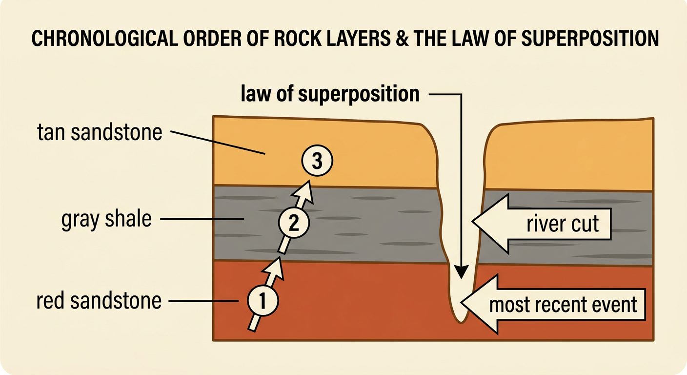
Rock layers can help scientists place events in chronological order, from earliest to most recent. In an undisturbed stack of sedimentary rock, the oldest layer is usually at the bottom because it formed first. Younger layers were deposited on top later. This pattern is called the law of superposition. Suppose a canyon wall has red sandstone at the bottom, gray shale in the middle, and tan sandstone at the top. The red sandstone formed first, the shale formed next, and the tan sandstone formed last. If a river later cuts through all three layers, the cutting happened after the layers formed. Earth movements can tilt, fold, or break layers, so scientists also look for signs of disturbance before deciding their ages.
Fossils as Evidence
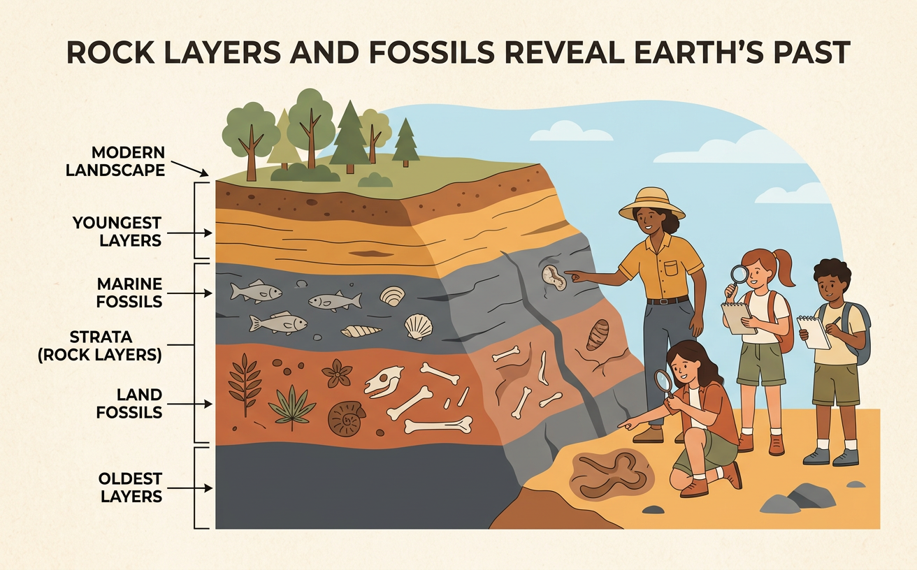
Fossils are preserved remains or traces of organisms that lived long ago. They can include bones, shells, leaf prints, footprints, or burrows. Fossils help scientists identify past environments because organisms need particular conditions to survive. For example, a limestone layer containing coral and seashell fossils is evidence that the area was once covered by warm, shallow seawater. A higher rock layer with fossilized tree leaves may show that the environment later became dry land with plants. The order of these fossils also helps build a timeline. The sea organisms lived before the land plants if their undisturbed layer is lower. Fossils do not show every organism that lived in a place, but they provide important evidence when studied with rocks and other clues.

Measuring and Comparing Layers
Measurements allow scientists to compare rock layers accurately. Layer thickness can be measured in millimeters, centimeters, meters, or kilometers. One meter equals 100 centimeters, and one kilometer equals 1,000 meters. Scientists choose a unit that fits the size being measured. For example, imagine that a shale layer is 2 meters thick and a sandstone layer is 350 centimeters thick. Convert 2 meters to 200 centimeters before comparing them. The sandstone layer is 150 centimeters thicker than the shale layer. A thicker layer may mean that more sediment collected, but it does not always mean that it formed during a longer time. Floods can deposit sediment quickly, while slow erosion can remove part of a layer. Measurements must be considered together with other evidence.

Explaining Landscape Change
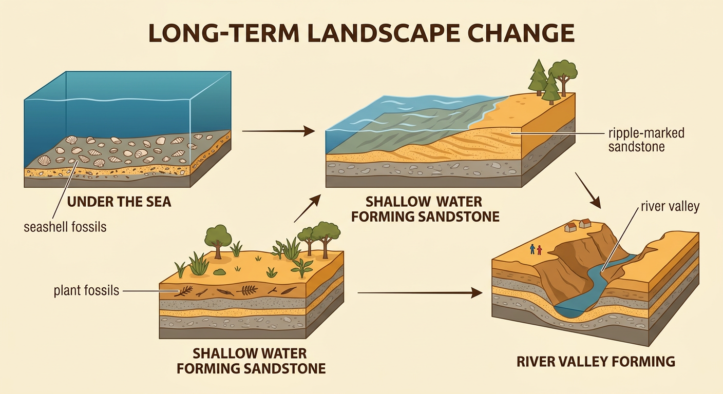
Scientists use rock layers, fossils, measurements, and landforms to explain how a landscape changed over long periods of time. A good explanation describes the evidence and puts events in chronological order. Consider a cliff with a bottom layer containing seashell fossils, a middle layer with ripple-marked sandstone, and an upper layer containing plant fossils. First, the area was under the sea, where shells collected. Next, shallower moving water deposited sand and formed ripple marks. Later, the area became dry land where plants grew. Finally, a river cut a valley through all three layers. This sequence is supported by the position of the layers and the clues inside them. Scientists may revise the explanation if new evidence is discovered, just as historians revise accounts when they find new sources.