Tenochtitlan: Building a City on a Lake
Students examine maps and historical evidence to explain how the Aztec adapted Tenochtitlan’s design, transportation, farming, and water systems to its lake environment.

Illustrations are auto-generated and may be placeholders. They can be refreshed to match the narration.
The Valley of Mexico
Tenochtitlan developed in the Valley of Mexico, a high basin surrounded by mountains and volcanoes. Several connected lakes covered the basin floor. Lake Texcoco, where Tenochtitlan stood, had salty or brackish water, while parts of the southern lake system held fresher water. Because the basin had no natural river outlet, heavy rains could raise lake levels and cause flooding. The lakes also offered fish, birds, reeds, fertile mud, and canoe routes. These environmental conditions created both opportunities and constraints. For example, island settlement provided protection and transportation, but residents needed reliable sources of drinking water. Maps of the valley help explain why the Aztec built causeways, canals, dikes, aqueducts, and raised farm plots instead of designing the city like an inland settlement.

Founding Tenochtitlan
According to Aztec historical traditions, the Mexica founded Tenochtitlan around 1325 on an island in Lake Texcoco. Later pictorial sources show an eagle perched on a cactus as a sign connected to the chosen location. Historians compare this tradition with archaeological evidence and accounts written after the Spanish conquest. These sources do not provide identical details, so each must be examined for its origin, purpose, and point of view. The island was small and marshy, but the Mexica gradually enlarged usable land by driving stakes into shallow water and adding stone, earth, and fill. Canals remained between sections of the growing city. For example, expanding the island created space for temples, homes, markets, and roads while preserving water routes for canoes. The city’s design therefore developed through both cultural choices and environmental adaptation.

Chinampas and Food Production
Chinampas were raised agricultural plots built in shallow lake areas, especially in the fresher southern lakes near Xochimilco and Chalco. They were not floating gardens. Farmers marked rectangular plots with wooden stakes and woven reeds, then added layers of lake mud and plant material. Trees planted along the edges helped hold the soil in place. Narrow canals allowed farmers to travel by canoe and move crops toward urban markets. Moist soil and nutrient-rich mud supported productive farming, sometimes allowing more than one harvest in a year. Farmers grew foods such as maize, beans, squash, tomatoes, and chili peppers. For example, a canoe could carry harvested vegetables from a chinampa through the canal network to Tenochtitlan’s market. This system changed wetlands into farmland while keeping channels open for irrigation and transportation.

Causeways, Canals, and Aqueducts
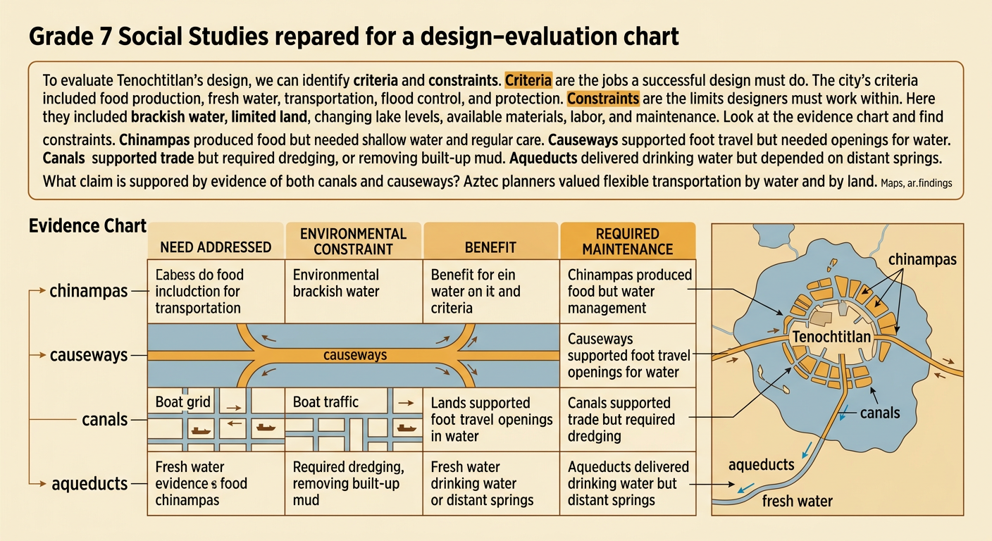
Tenochtitlan depended on connected transportation and water-control systems. Raised causeways linked the island city to the mainland at Tlacopan, Tepeyac, and Iztapalapa. Openings and removable bridges in the causeways allowed canoes and water to pass. Inside the city, canals carried people and goods, while streets supported travel on foot. Since Lake Texcoco’s water was not suitable for drinking, aqueducts brought fresh spring water from Chapultepec. A major dike associated with Nezahualcoyotl helped reduce flooding and limited the movement of salty water toward fresher areas. Each structure addressed a different need but also faced constraints such as unstable lakebed soil, changing water levels, labor demands, and required maintenance. For example, merchants could bring produce by canoe while pedestrians entered along a causeway, making the city accessible through two transportation networks.

Reading a Scale Map
A scale map represents real distances with smaller measured distances. Suppose a map of the Valley of Mexico has a scale of 1 centimeter equals 2 kilometers. If the distance from Tenochtitlan to a mainland location measures 4.5 centimeters, multiply 4.5 by 2. The actual distance is 9 kilometers. To create a scale drawing, divide an actual distance by the scale value. A 6-kilometer route would be drawn 3 centimeters long because 6 divided by 2 equals 3. Always include units and check whether the measurement follows a straight line or a curved route. For example, a canoe route around shallow water may be longer than the straight-line distance shown between two points. Scale calculations help historians compare travel routes, farmland locations, and the size of the lake environment.

Evaluating Aztec Urban Design
Engineers evaluate a design by identifying its criteria and constraints. For Tenochtitlan, criteria included producing food, supplying fresh water, transporting people and goods, controlling floods, and protecting the city. Constraints included brackish water, limited island land, seasonal changes in lake level, available materials, labor, and maintenance. No single structure met every need. Chinampas increased food production but required shallow water and regular care. Causeways offered dependable foot travel but could block water movement unless openings were included. Canals supported trade but needed dredging, while aqueducts delivered drinking water but depended on distant springs. Students can evaluate the city by citing map features, archaeological findings, and historical accounts. For example, evidence of both canals and causeways supports the claim that Aztec planners valued flexible transportation. Their cultural priorities and economic decisions reshaped the lake while also responding to its limits.