The Erie Canal: Connecting Regions and Expanding Trade
Students use maps and historical evidence to explain why the Erie Canal was built and how it changed transportation, trade, and migration in the United States.

Illustrations are auto-generated and may be placeholders. They can be refreshed to match the narration.
The Transportation Challenge
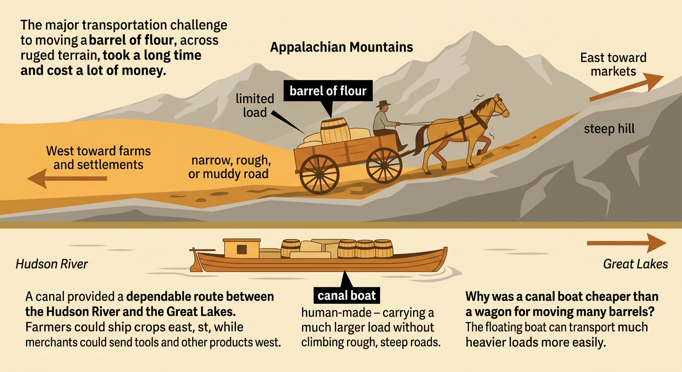
In the early 1800s, moving people and goods between the Atlantic Coast and lands west of the Appalachian Mountains was slow, difficult, and expensive. Roads were often narrow, rough, or muddy. Wagons could carry only limited loads, and steep hills made travel harder. Rivers helped, but many did not flow in the direction travelers needed to go. New York leaders wanted a dependable water route connecting the Hudson River with the Great Lakes. Such a route could help farmers send crops to eastern markets and allow merchants to ship tools and other products west. For example, carrying a barrel of flour by wagon over rough roads took more time and cost more than carrying it on a canal boat. The need for cheaper, faster transportation became the design problem that the Erie Canal was built to solve.
Mapping the Canal Route
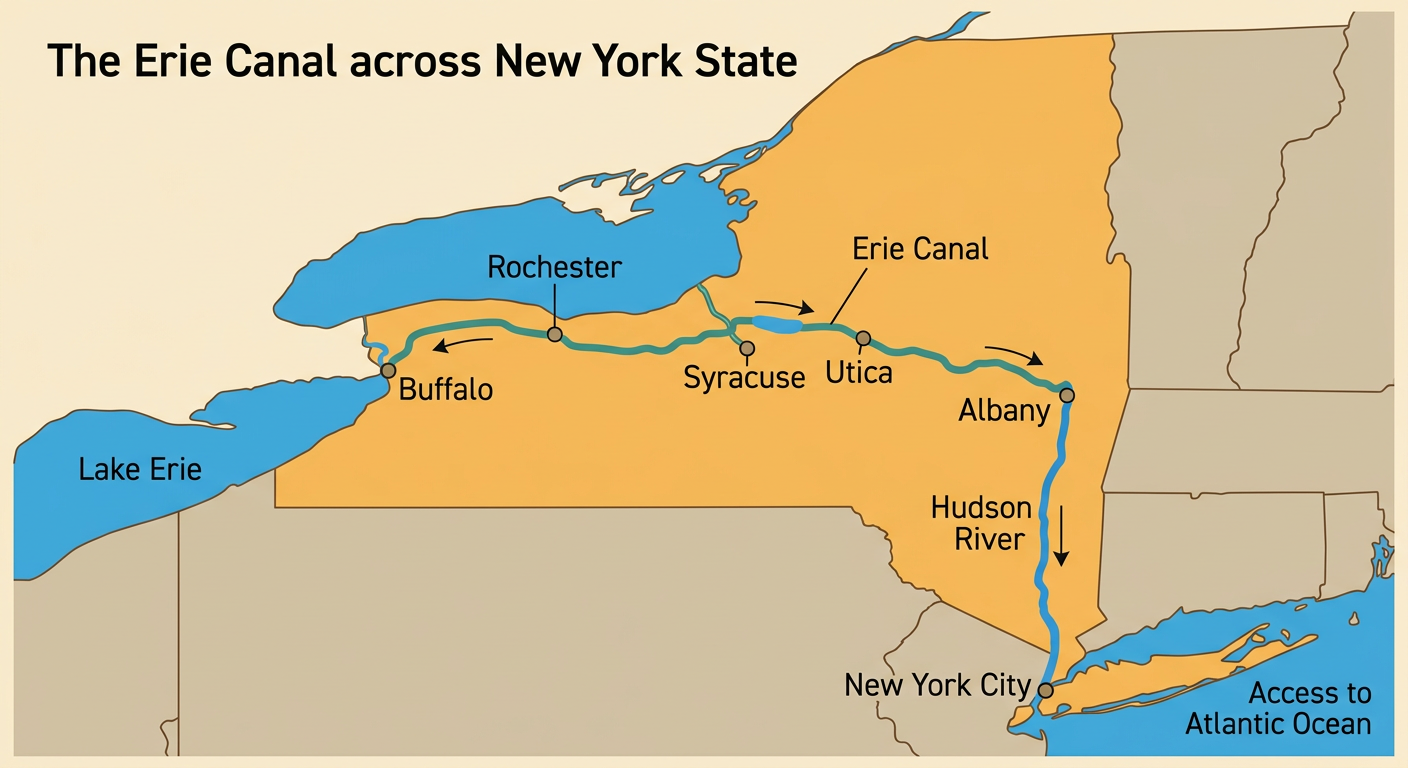
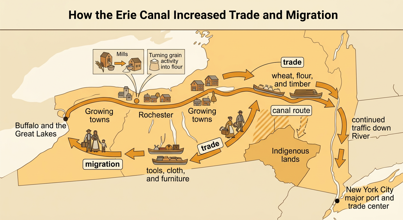
The Erie Canal crossed New York State from Albany on the Hudson River to Buffalo on Lake Erie. Completed in 1825, the original canal was about 363 miles long. Its location connected two major water systems. From Albany, boats could travel south on the Hudson River to New York City and the Atlantic Ocean. From Buffalo, travelers and goods could enter Lake Erie and reach other parts of the Great Lakes region. The route also passed communities such as Utica, Syracuse, and Rochester, helping them grow. On a map, the canal appears as an east-west link between the coast and the interior. For example, wheat shipped from a farm near Rochester could travel by canal boat to Albany, then continue down the Hudson River to New York City for sale.
Building an Engineering Solution
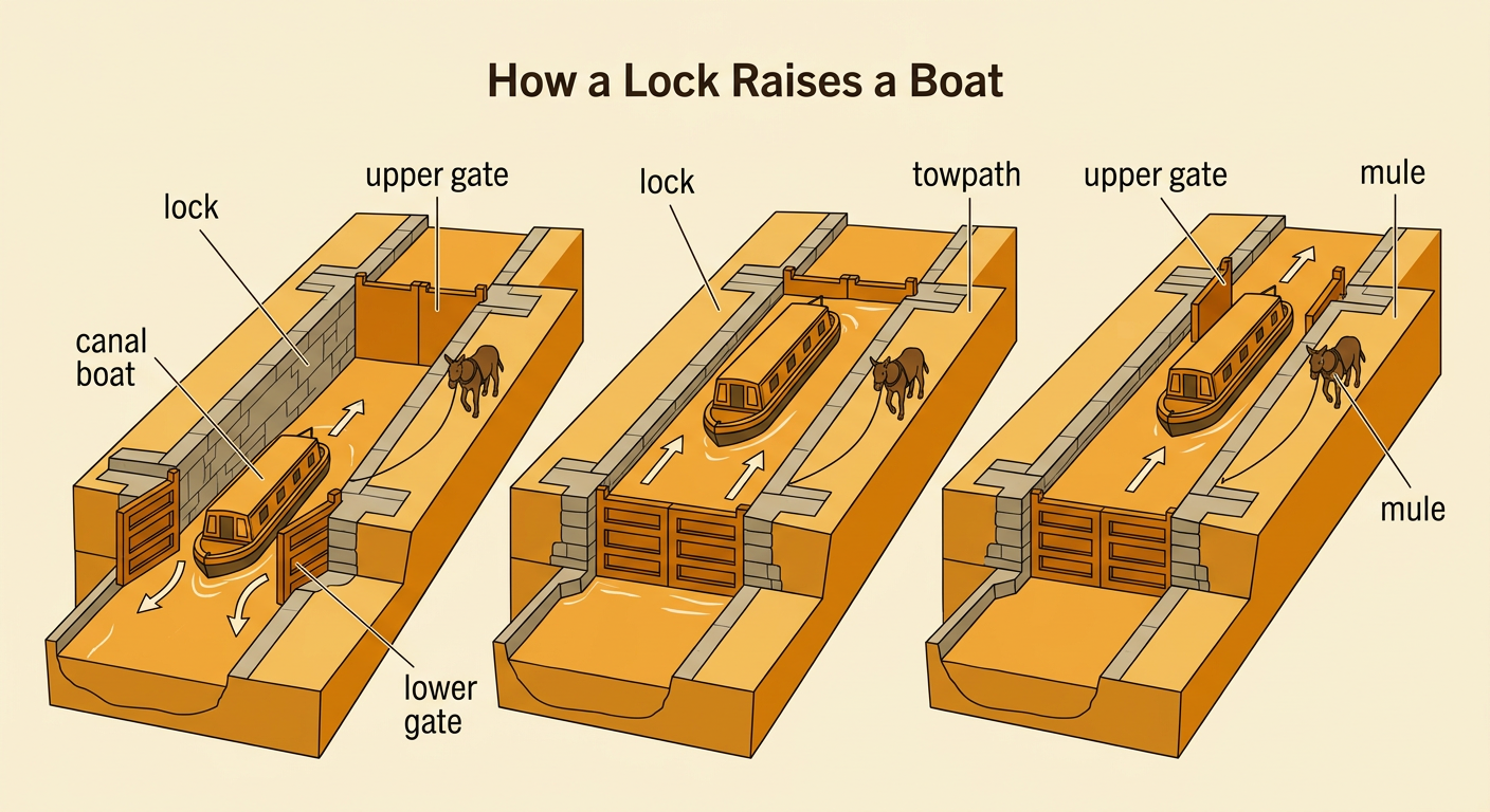
Building the Erie Canal required workers and engineers to solve several problems. The land was not level, and the route crossed rivers, forests, rocky ground, and swamps. Locks were built to raise or lower boats between sections of water at different elevations. Inside a lock, gates closed around a boat, and water flowed in or out until the boat reached the next level. Aqueducts carried canal water and boats across some rivers and streams. Workers dug much of the canal using hand tools and removed trees, rocks, and soil. Horses or mules walked on a towpath beside the canal and pulled boats with ropes. For example, a boat approaching higher ground entered a lock, the lower gate closed, and added water lifted the boat before the upper gate opened.
Trade and Migration
The Erie Canal changed how goods and people moved across the United States. Farmers in western New York and the Great Lakes region could send wheat, flour, timber, and other products east at lower cost. Eastern businesses shipped tools, cloth, furniture, and manufactured goods west. New York City became a major trade center because canal traffic reached the city through the Hudson River. The canal also encouraged migration. Families traveled west in search of farmland, jobs, and new communities, while towns along the route grew rapidly. For example, Rochester expanded as nearby mills processed grain that could be shipped through the canal. Growth also had harmful effects. Increased settlement contributed to the loss of Indigenous lands and disrupted Indigenous communities. The canal therefore created economic opportunities for many people while also causing unequal and lasting changes.
Examining Historical Evidence
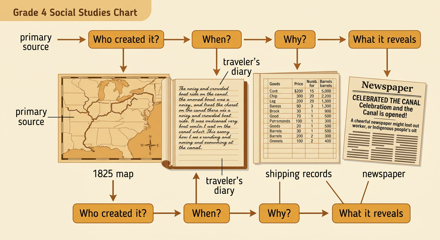
Historians use evidence to learn how people experienced the Erie Canal. Primary sources were created during the period being studied. They include letters, diaries, newspapers, advertisements, maps, paintings, and shipping records. A canal boat advertisement might list travel times and ticket prices, while a merchant’s record might show how many barrels of flour were shipped. Historians ask who created each source, when it was made, why it was created, and what information may be missing. A newspaper celebrating the canal’s opening could show public excitement, but it might not describe the experiences of workers or Indigenous people. Comparing several sources creates a fuller account. For example, students can compare an 1825 map with a traveler’s diary and a list of shipping costs to determine the canal’s route, travel conditions, and economic effects.
Explaining the Canal’s Impact
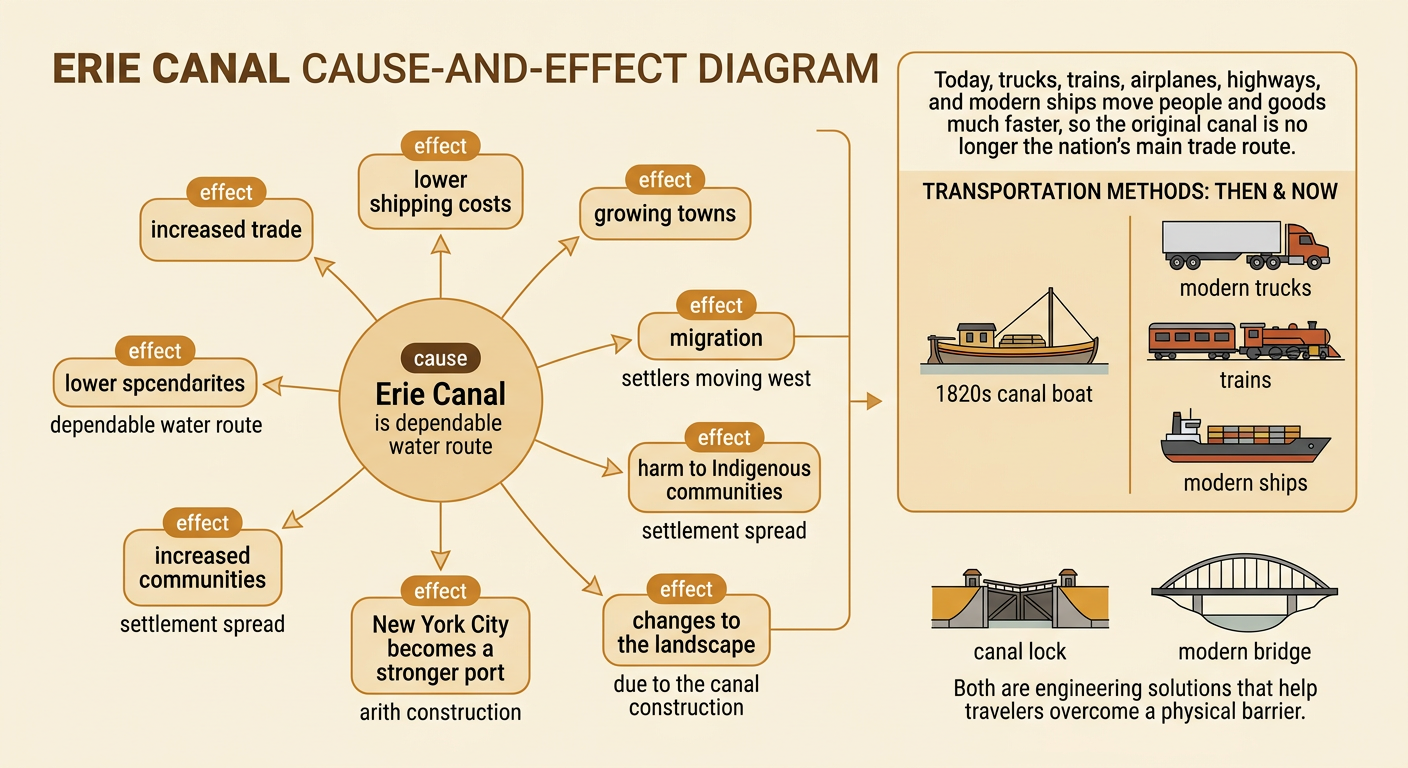
The Erie Canal had effects that can be explained through cause and effect. Because the canal created a dependable water route, shipping became faster and less expensive than many forms of overland travel. Lower transportation costs increased trade, helped towns grow, strengthened New York City’s role as a port, and encouraged migration toward the Great Lakes region. The canal also changed landscapes and communities, including Indigenous communities affected by expanding settlement. Transportation today is different. Trucks, trains, airplanes, highways, and modern ships move people and goods much faster, and the original canal is no longer the nation’s main trade route. However, the same basic need remains: people design transportation systems to connect places efficiently. For example, just as locks helped canal boats cross changes in elevation, modern engineers design bridges, tunnels, and highway ramps to overcome physical barriers.