The Erie Canal: Engineering a New American Economy
Students examine how geography, engineering, and transportation data explain the Erie Canal’s effects on trade, migration, urban growth, and Indigenous lands.

Illustrations are auto-generated and may be placeholders. They can be refreshed to match the narration.
The Transportation Challenge
In the early 1800s, moving people and goods across the United States was slow and expensive. Roads were often muddy, rough, or blocked by snow, and wagons could carry only limited loads. Farmers west of the Appalachian Mountains had difficulty reaching large eastern markets. New York leaders proposed a canal connecting the Hudson River with Lake Erie. Boats could carry much heavier cargo than wagons because water supported the load and reduced friction. For example, flour shipped from western New York could travel by canal to Albany, continue down the Hudson River, and reach New York City. The Erie Canal, completed in 1825, created a continuous water transportation route between the Great Lakes region and the Atlantic coast. This route reduced travel time and shipping costs.

Geography of the Canal Route
Geography shaped where the Erie Canal could be built. Much of the Appalachian mountain system formed a barrier between the Atlantic coast and the interior. In New York, however, the Mohawk River valley provided a relatively low passage through the highlands. Surveyors planned the canal from Albany on the Hudson River west through the Mohawk Valley to Buffalo on Lake Erie. The approximately 363-mile route crossed rivers, wetlands, forests, and areas with changing elevation. Engineers followed level land when possible because steep slopes required more locks and construction. For example, the canal passed through the Mohawk Valley rather than crossing higher mountains to the south. A route map helps explain how a natural landform influenced an economic decision: New York used its geographic advantage to connect the Great Lakes with an Atlantic port.

Engineering the Erie Canal
Canal engineers had to move boats across uneven land while keeping enough water in the channel. The original canal was about 40 feet wide at the surface and 4 feet deep. Locks solved elevation changes by raising or lowering boats inside gated chambers. Aqueducts carried the canal over rivers, while embankments supported it across low ground. Near Lockport, workers cut through the Niagara Escarpment and built a staircase of locks to overcome a major rise. Engineers compared solutions by considering test results, cost, available materials, construction time, leakage, and durability. For example, a model test might show that a clay-lined channel loses less water than an unlined channel, but it may require more labor. Engineers would use such evidence, along with local soil conditions, to select the most effective design rather than choosing only the least expensive option.

Reading Trade and Population Data
Transportation effects can be investigated by organizing paired data and looking for associations. One useful scatter plot pairs census year with Buffalo’s population: about 2,095 people in 1820, 8,668 in 1830, 18,213 in 1840, and 42,261 in 1850. The plotted points rise from left to right, showing a strong positive association between time and population during the canal era. Historical estimates also indicate that shipping a ton of freight from Buffalo to New York City fell from roughly $100 before the canal to about $10 after it opened, although estimates differ by source and year. Students should compare the graph with maps, census records, and written accounts. The data support the claim that transportation improvements encouraged growth, but a scatter plot alone does not prove causation. Immigration, business investment, agricultural production, and other changes also influenced Buffalo’s population.

Economic Growth and Urban Change
The Erie Canal reorganized trade by linking Great Lakes producers with merchants in New York City. Farmers sent wheat, flour, timber, and other products east, while manufactured goods and new settlers traveled west. Warehouses, mills, docks, stores, and banks developed at canal stops. Cities including Buffalo, Rochester, Syracuse, and Utica grew as transportation and commercial centers. Rochester, for example, used waterpower from the Genesee River to operate flour mills, while canal boats carried the flour to larger markets. New York City gained access to western trade and became the nation’s leading commercial port. Growth also changed urban land use: waterfronts became busy industrial areas, labor demand increased, and neighborhoods expanded. These benefits were uneven. Canal businesses and landowners could earn profits, while workers often performed difficult jobs for low wages and faced crowded living conditions.

Effects on Indigenous Lands and Communities
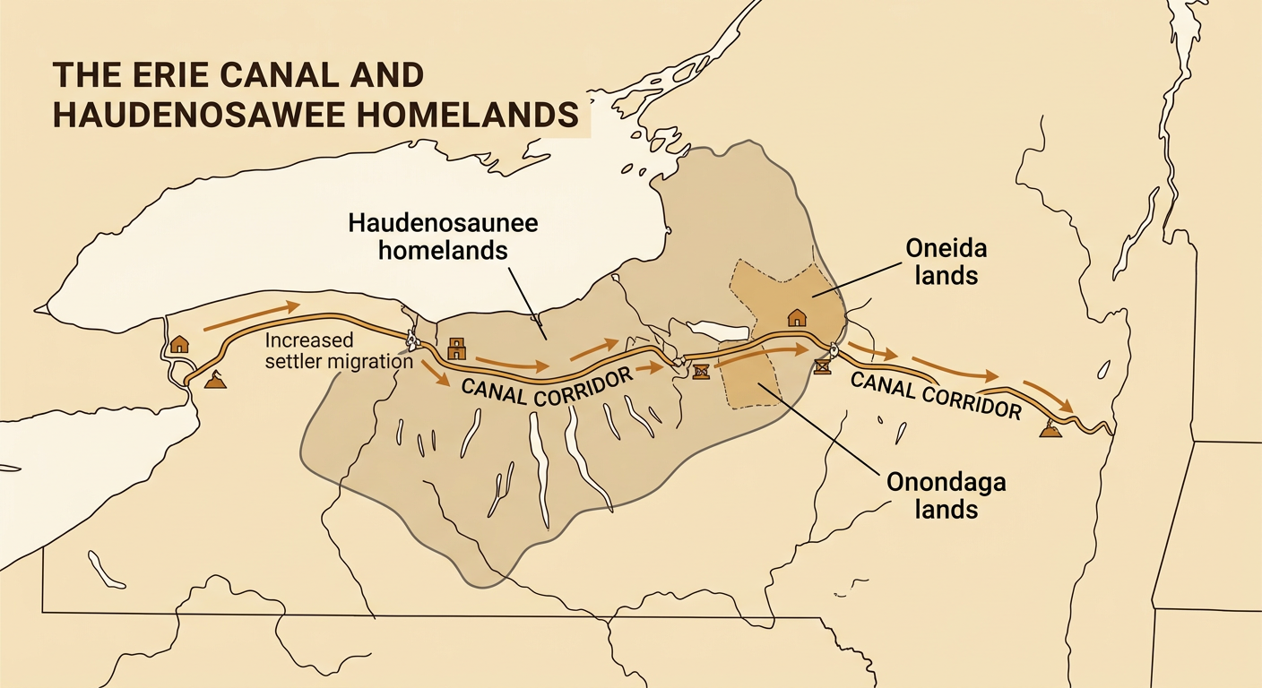
The canal crossed the homelands of the Haudenosaunee, whose nations include the Mohawk, Oneida, Onondaga, Cayuga, Seneca, and Tuscarora. Indigenous land loss had begun before construction through warfare, treaties, land sales, and government pressure, but the canal accelerated migration and commercial settlement across New York. Rising land values increased pressure to transfer more Indigenous land, sometimes through agreements whose fairness or legality was disputed. Farms, towns, roads, and industries also changed forests, waterways, fisheries, and hunting areas. For example, growth along the canal corridor increased settlement near Oneida and Onondaga lands and connected those areas more closely to outside markets. These changes did not erase Indigenous communities. Haudenosaunee people resisted removal, maintained governments and cultural traditions, adapted economic activities, and continued living in New York. Evaluating the canal therefore requires examining both economic growth and its unequal human and environmental costs.