
The Louisiana Purchase: Expansion and Its Consequences
Students use maps and historical evidence to explain why the United States purchased Louisiana and how expansion affected settlers, Indigenous nations, and natural resources.

Illustrations are auto-generated and may be placeholders. They can be refreshed to match the narration.
The United States Before 1803
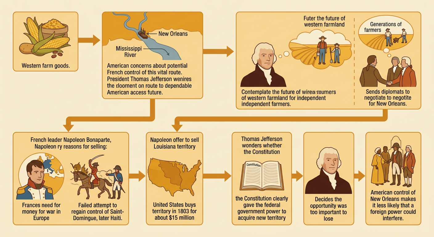
Before 1803, the United States extended from the Atlantic coast to the Mississippi River. Spain controlled New Orleans and the vast Louisiana territory west of the river, although many Indigenous nations governed their own homelands there. New Orleans was especially important because goods traveling down the Mississippi passed through its port before reaching the Gulf of Mexico. Farmers depended on this route to reach distant markets. For example, a farmer in Kentucky could load flour onto a flatboat, float it down the Ohio and Mississippi Rivers, and sell it through New Orleans. Spain secretly agreed to return Louisiana to France in 1800, and Americans worried that French control might threaten their trade. Geography, international politics, and the needs of western settlers therefore made control of the Mississippi River a major national concern.

Why Jefferson Wanted Louisiana
President Thomas Jefferson wanted reliable American access to the Mississippi River and New Orleans. He also believed that western farmland could support generations of independent farmers. Jefferson first sent diplomats to negotiate for New Orleans. However, French leader Napoleon Bonaparte offered to sell the entire Louisiana territory. France needed money for war in Europe, and its attempt to regain control of Saint-Domingue, later Haiti, had failed. In 1803, the United States agreed to pay about $15 million for Louisiana. Jefferson questioned whether the Constitution clearly allowed the federal government to acquire new territory, but he decided the opportunity was too important to lose. For example, American ownership of New Orleans meant that a farmer shipping corn downriver would be less likely to have access blocked by a foreign government.
Reading the Purchase Map
A map helps explain the purchase’s enormous scale. The Louisiana Purchase stretched generally from the Mississippi River toward the Rocky Mountains and from the Gulf Coast toward present-day Canada. Some boundaries were disputed, so historical maps may show uncertain border lines. The territory covered about 828,000 square miles and nearly doubled the claimed size of the United States. Present-day state outlines can help students locate the area, but most of those states did not exist in 1803. For example, nearly all of present-day Missouri and Iowa lay within the purchase. A careful reader should use the title, legend, compass rose, and scale to interpret the map. The map should also identify Indigenous homelands because the purchase transferred France’s claimed rights without obtaining the consent of the nations already living there.

Effects on National Expansion
The purchase encouraged the United States to explore, map, govern, and settle lands farther west. Jefferson sent the Lewis and Clark expedition from 1804 to 1806 to gather geographic and scientific information and seek trade relationships with Indigenous nations. Their party recorded rivers, plants, animals, and travel routes, with essential assistance from Indigenous people, including Sacagawea. Over time, Congress organized territories, created roads, and admitted new states from the purchased land. Settlers moved west seeking farms, trade, and other opportunities. For example, Missouri became a state in 1821 after its population grew. Expansion also caused political conflict because Americans argued over whether slavery would be allowed in new states and territories. National growth therefore connected exploration and settlement with new disputes about power, land, and law.

Consequences for Indigenous Nations and Resources
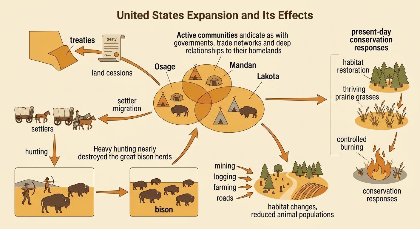
The purchase did not mean that the land was unoccupied. Indigenous nations, including the Osage, Mandan, and Lakota, had governments, trade networks, and deep relationships with their homelands. France sold its claim without their consent. As American settlement increased, the United States pressured nations into treaties and land cessions, restricted movement, and sometimes used military force. Expansion also changed natural resources. More hunting, mining, logging, farming, and road building reduced some habitats and animal populations. For example, intensive nineteenth-century hunting nearly destroyed the great bison herds that many Plains nations depended on for food, clothing, tools, and cultural practices. Communities can use scientific and traditional ecological knowledge to protect resources through habitat restoration, controlled burning, limits on harvesting, and water conservation. These methods show that choices about land can have long-lasting human and environmental effects.
Evaluating the Purchase
Evaluating the Louisiana Purchase requires more than deciding whether it was a bargain. The United States paid about $15 million, gained control of New Orleans, and claimed roughly 828,000 square miles. These results supported trade, settlement, exploration, and national growth. However, the purchase also increased pressure on Indigenous nations, spread conflicts over slavery, and encouraged resource use that changed ecosystems. Historians compare evidence such as the purchase treaty, Jefferson’s letters, maps, Indigenous accounts, trade records, and environmental data. Each source answers different questions and may represent a different point of view. For example, a merchant might praise safer shipping on the Mississippi, while an Indigenous account might describe lost land or disrupted hunting. A strong evaluation uses specific evidence to explain both benefits and harms rather than presenting expansion as a simple story of progress.
