
Trade Routes: Resources, Distance, and Cultural Exchange
Students analyze maps and resource patterns to explain why ancient societies developed trade routes and how trade spread goods, technologies, and ideas.
Illustrations are auto-generated and may be placeholders. They can be refreshed to match the narration.
Why Societies Traded
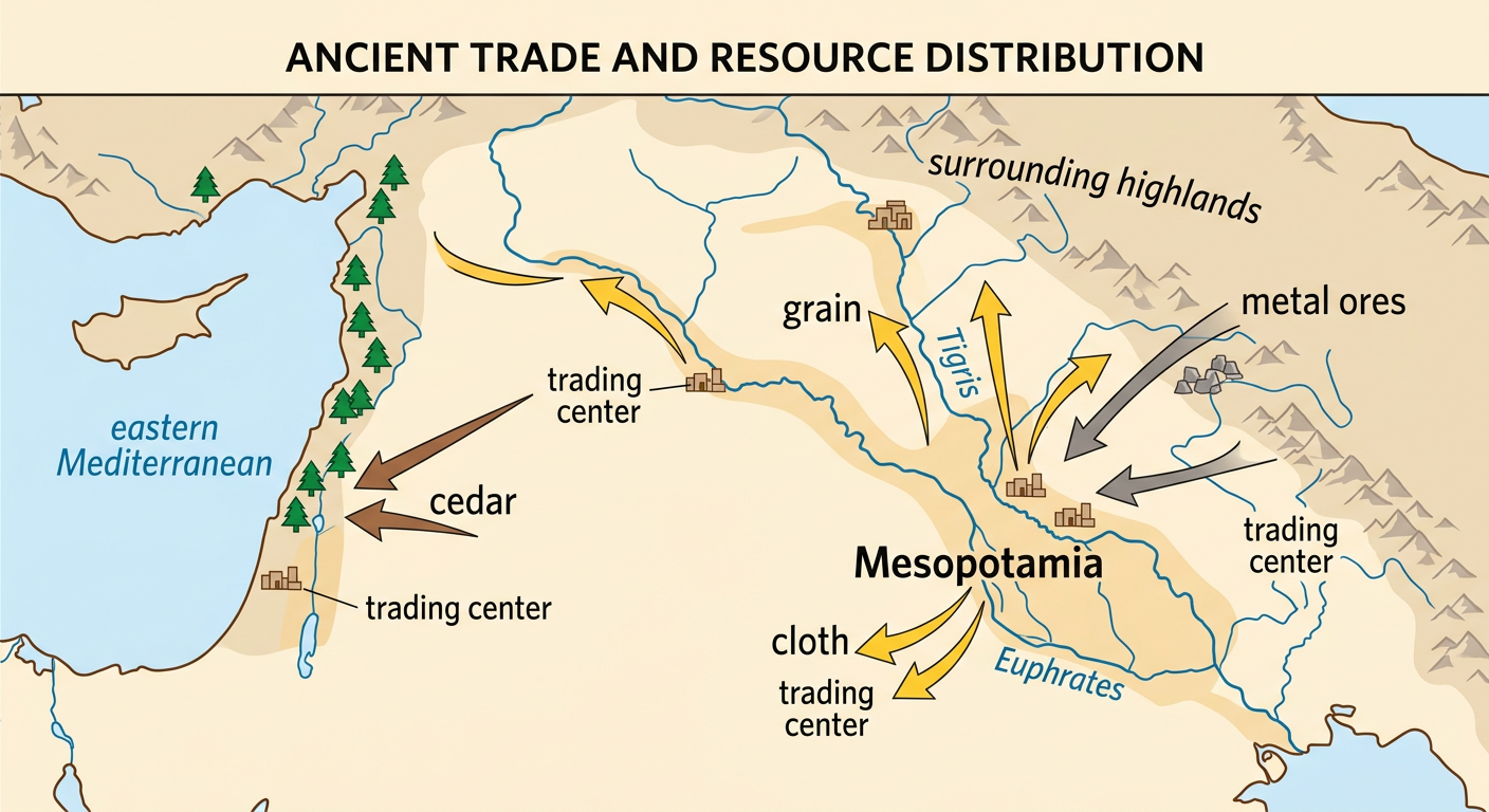
Ancient societies traded because no region had every resource people needed or wanted. Geoscience processes created uneven resource patterns. For example, rivers deposited fertile soil in Mesopotamia, helping farmers grow grain, but the region had limited supplies of timber and metal ores. Mesopotamian communities could exchange grain, cloth, and other products for cedar from the eastern Mediterranean and metals from neighboring highlands. Trade also allowed craftspeople to obtain valuable materials such as copper, tin, stone, and dyes. Distance, mountains, deserts, and seas made exchange difficult, so traders looked for routes that reduced danger and travel time. Settlements located near rivers, ports, mountain passes, or desert wells often became trading centers. People traded to meet basic needs, earn wealth, and gain access to rare or desirable goods.
Mapping Resources and Trade Routes
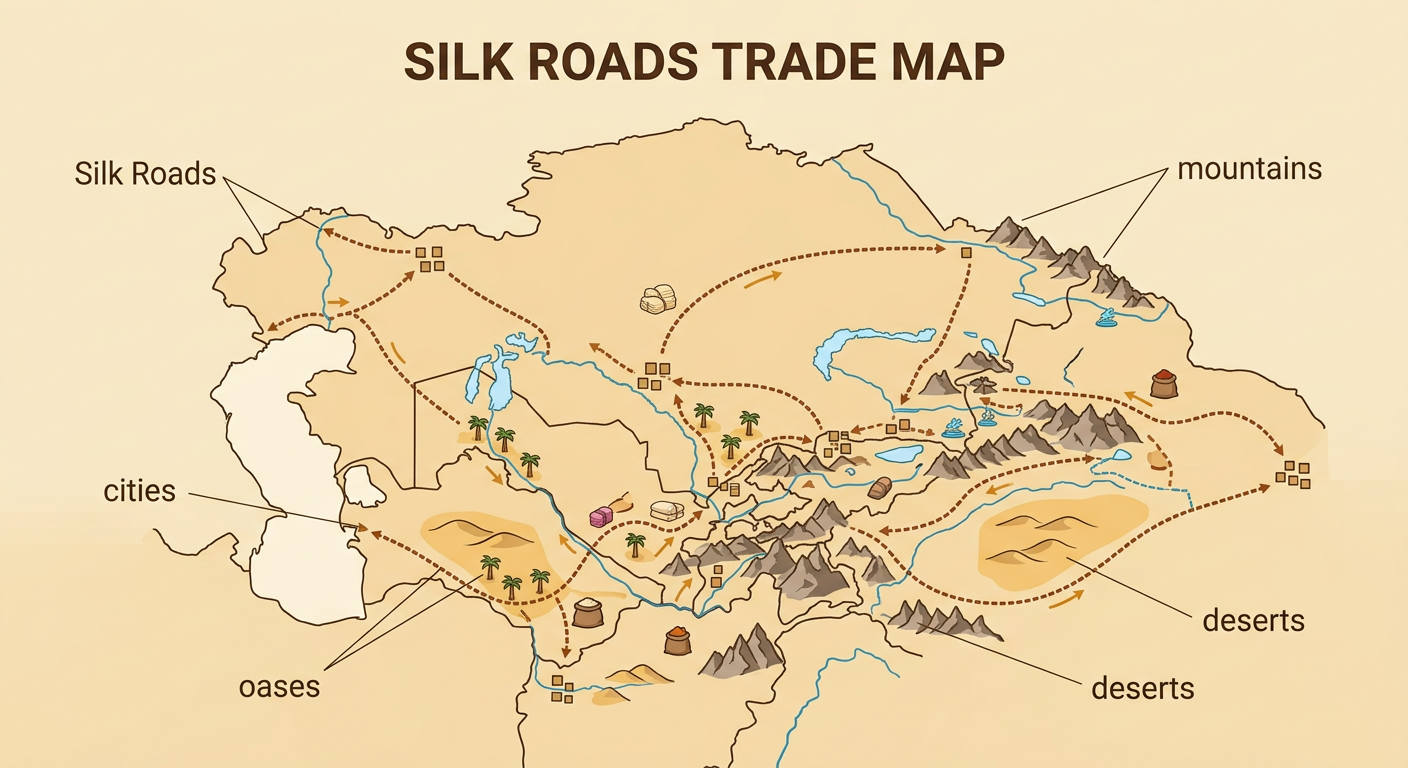
Maps help historians compare the locations of resources, settlements, and transportation routes. A useful trade map may show rivers, coastlines, mountains, deserts, roads, ports, and oases. Traders usually followed routes that provided water, food, shelter, or easier terrain. On the Silk Roads, caravans did not cross Asia on one continuous road. They traveled along connected routes linking cities and oases. Mountains and deserts limited movement, while passes and reliable water sources directed travelers toward particular paths. To analyze a map, first locate the resources and settlements. Next, trace the routes connecting them. Then use a written source, such as a travel account or list of traded goods, to explain the pattern. If a text mentions caravan stops and a map shows oases, the two sources together explain how people crossed dry regions.
Calculating Travel Distance
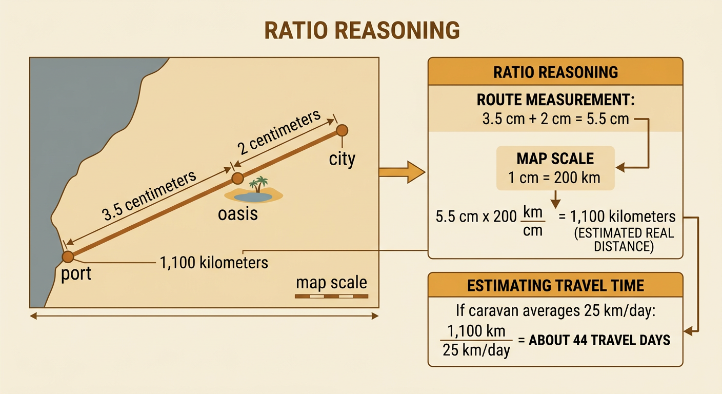
A map scale converts a distance measured on a map into an estimated real-world distance. Suppose a trade map uses the scale 1 centimeter equals 200 kilometers. A route measures 3.5 centimeters from a port to an oasis and 2 centimeters from the oasis to a city. The total map distance is 5.5 centimeters. Multiply 5.5 by 200 to find a real distance of 1,100 kilometers. This is ratio reasoning because every centimeter represents the same number of kilometers. Rates can also estimate travel time. If a caravan averages 25 kilometers per day, divide 1,100 by 25. The trip would take about 44 travel days under ideal conditions. Actual travel could take longer because traders stopped to rest, exchange goods, find water, wait for safe weather, or cross difficult terrain.
Goods, Ideas, and Technologies on the Move
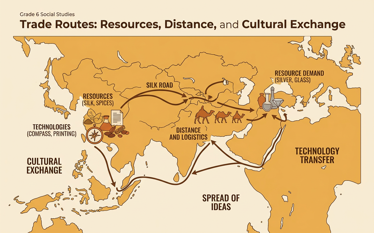
Trade routes carried more than physical goods. Merchants, sailors, craftspeople, pilgrims, and travelers also shared languages, religious beliefs, artistic styles, scientific knowledge, and technologies. Along routes across Asia, silk and other goods moved between regions, while Buddhism spread from South Asia into parts of Central and East Asia. Papermaking began in China and later spread westward over centuries through contact among societies. Communities did not simply copy every new idea. They selected, rejected, or changed practices to fit local needs. A design might be combined with local artistic traditions, or a technology might be adapted to available materials. Transportation made contact possible, while conversations in markets, ports, caravan stops, and cities communicated information. This process, called cultural diffusion, could gradually change daily life across distant societies.

Explaining the Impact of Ancient Trade
Ancient trade changed settlements and connected distant societies. Towns near ports, river crossings, oases, and mountain passes could grow because travelers needed food, lodging, animals, repairs, and markets. Palmyra, an oasis city in present-day Syria, became an important caravan center connecting routes between the Roman world and lands farther east. Trade brought wealth to some merchants and governments, but its benefits were not equal. Rulers could collect taxes, while workers produced goods or maintained roads. Long-distance contact also had risks, including theft, conflict, and the spread of disease. To explain trade's impact, combine evidence: identify the route on a map, calculate its distance, note the resources or goods exchanged, and use written sources to describe cultural changes. A strong explanation links transportation and communication to settlement growth and the diffusion of ideas and practices.
