
Westward Expansion: Opportunity, Displacement, and Environmental Change
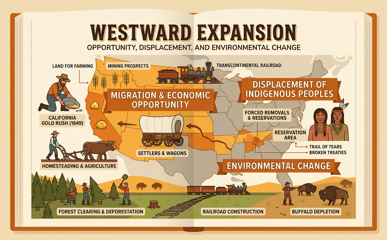
Students examine maps, data, and primary sources to evaluate how westward expansion created economic opportunities while displacing Indigenous peoples and transforming western environments.
Illustrations are auto-generated and may be placeholders. They can be refreshed to match the narration.
Motives for Moving West
People moved west for different economic, political, and personal reasons. The belief in Manifest Destiny encouraged many Americans to view continental expansion as both justified and inevitable. Farmers sought inexpensive land, merchants wanted new markets, miners pursued valuable minerals, and some families hoped for greater independence. Federal policies supported these goals. For example, the Homestead Act of 1862 offered eligible settlers up to 160 acres of public land if they lived on and improved it for five years. Railroads and land companies also advertised western opportunities, although their claims often ignored drought, isolation, and Indigenous ownership. When analyzing an advertisement or a settler’s letter, cite exact words describing expected benefits or difficulties. Then connect that evidence to broader contexts, such as industrial growth, immigration, federal land policy, and competition over natural resources.

Mapping Trails and Settlement
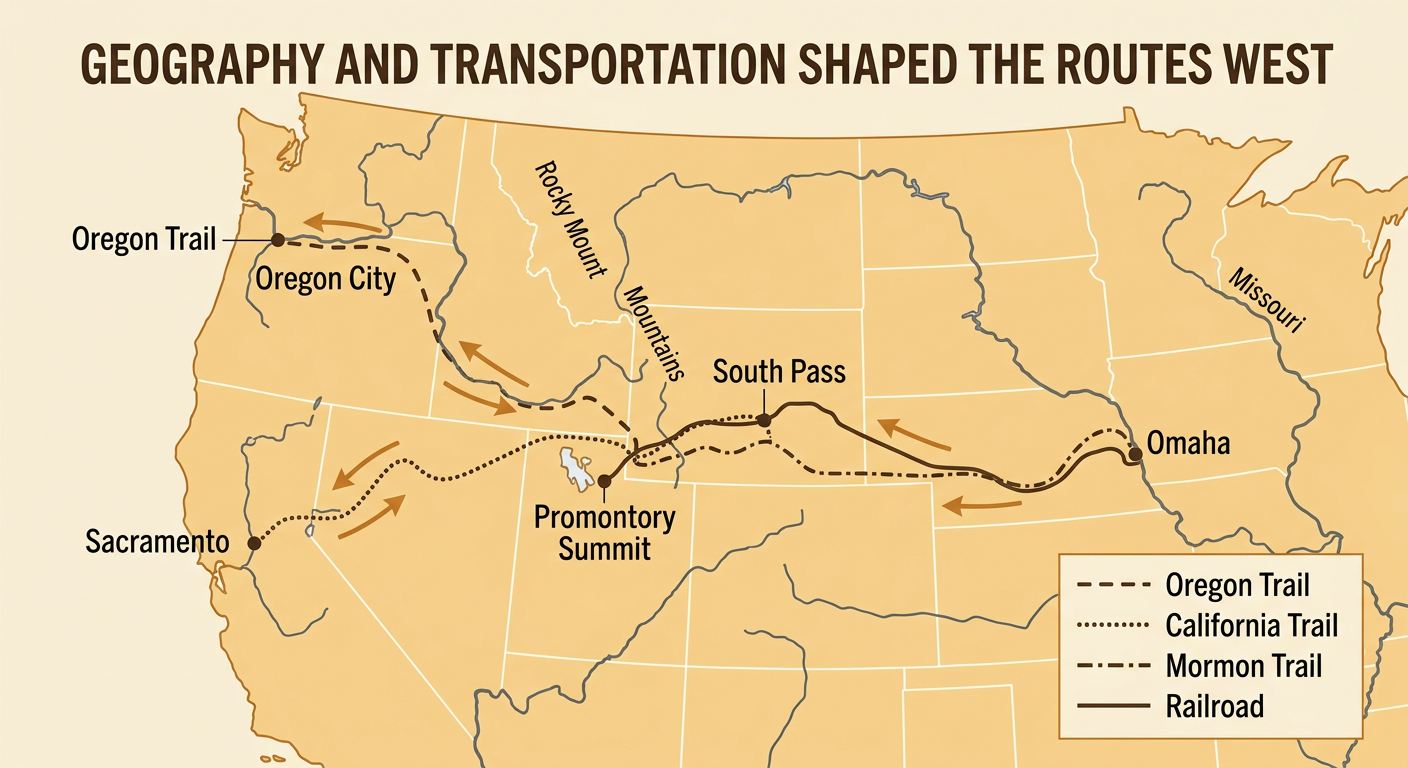
Maps reveal how geography and transportation shaped migration. The Oregon Trail began near Independence, Missouri, followed river valleys and mountain passes, and ended near Oregon City. Much of the California Trail followed the same route before branching toward California, while the Mormon Trail connected Nauvoo, Illinois, with the Salt Lake Valley. Travelers depended on rivers for water and used South Pass because it provided a relatively gradual crossing of the Rocky Mountains. Later, railroads moved people and goods much faster than wagon trails. In 1869, the Union Pacific and Central Pacific railroads met at Promontory Summit, Utah, completing the first transcontinental railroad. To interpret a map, examine its title, legend, scale, physical features, and dates. Compare routes with settlement locations to determine how access to water, fertile land, mineral deposits, and transportation influenced where communities developed.
Indigenous Displacement and Resistance
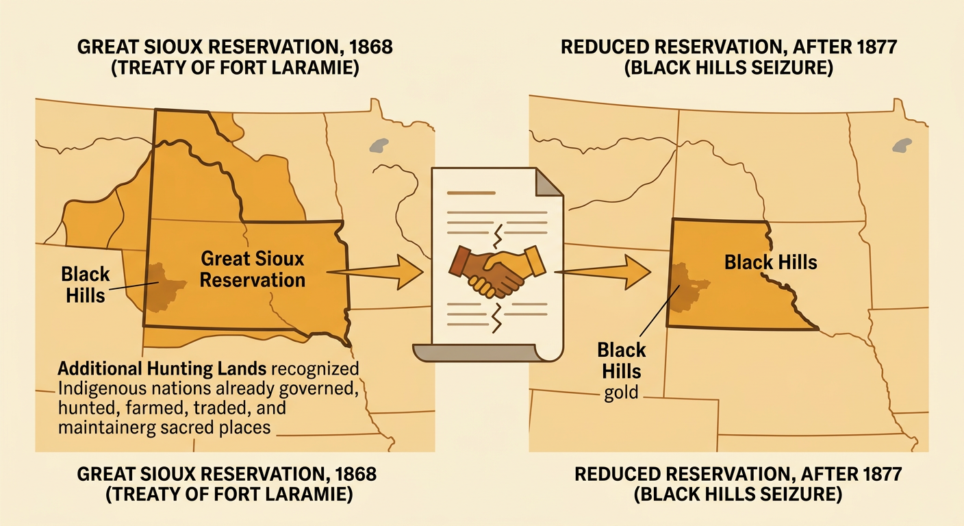
Westward expansion occurred on lands where Indigenous nations already lived, governed, hunted, farmed, traded, and maintained sacred places. Treaties often recognized Native territory, but settlers and federal officials repeatedly violated or revised those agreements when valuable land or resources were desired. The 1868 Treaty of Fort Laramie established the Great Sioux Reservation and recognized Lakota rights in additional hunting lands. After gold was found in the Black Hills, miners entered the area, and the federal government seized the Black Hills in 1877. Indigenous peoples responded through diplomacy, legal claims, cultural survival, relocation, and armed resistance. A careful historian compares treaty language with later maps, laws, speeches, and Native accounts. Specific quotations can show what was promised, while maps can show how land control changed. These sources should be interpreted within the broader context of settler migration, railroad construction, military power, and demand for resources.
Population Data and Resource Use
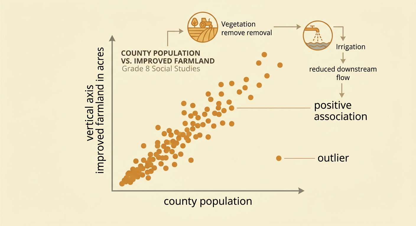
Population growth increased demand for land, water, timber, minerals, and food across the West. Students can investigate this relationship with a scatter plot using historical data. For example, place the population of selected western counties on the horizontal axis and acres of improved farmland on the vertical axis. Each point represents one county in the same census year. If points generally rise from left to right, the variables have a positive association: counties with larger populations often had more developed farmland. An outlier might be a densely populated mining county with little farmland. The pattern does not prove that population alone caused land development, because rainfall, soil, markets, and technology also mattered. Increased farming and grazing removed native vegetation, while irrigation changed river flow and mining produced waste and sediment. Evidence from both the graph and historical sources can support an explanation of how human activity affected Earth’s systems.
Evaluating the Consequences of Expansion
Westward expansion produced benefits for some groups while imposing severe costs on others. Settlers, railroad companies, merchants, and mining businesses gained land, transportation links, jobs, and access to resources. New farms and towns helped connect regional markets to the national economy. At the same time, Indigenous nations lost land and access to important resources, and many communities experienced warfare, forced confinement, or attacks on their cultures. Environmental effects included grassland conversion, altered rivers, deforestation, mining pollution, and the destruction of wildlife habitat. For example, railroads supported trade and migration, but they also crossed Native lands and helped hunters reach bison herds; commercial hunting contributed to the bison’s near disappearance by the late 1800s. A strong evaluation uses multiple sources, identifies who benefited and who experienced harm, and considers both immediate and long-term effects rather than labeling expansion as simply positive or negative.
